


Mountain climbing: Mt. Pinneshiri - Mt. Apoi Traversing Route
Mt. Apoi Area
- 8-hour route
- Geosite map Download PDF file
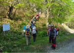
This mountaineering route known for its flowers and panoramic views traverses the peridotite Apoi Mountains (Mt. Pinneshiri - Mt. Apoi).
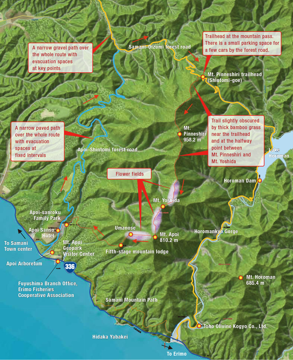
Taking the Mt. Pinneshiri-Mt. Apoi Traversing Route generally involves driving to the Mt. Pinneshiri trailhead, climbing the mountain and descending to the Mt. Apoi trailhead. However, this is logistically difficult because climbers need to get back to the Mt. Pinneshiri trailhead to pick up their cars. To address this problem, the Apoi Sanso Hotel near the Mt. Apoi trailhead provides transportation to the Mt. Pinneshiri trailhead for guests based on advance arrangement.
The trails in the Mt. Pinneshiri area can be difficult to follow due to the growth of thick bamboo grass there. It is advisable to have a geopark guide or a tour leader who knows the trails well.
Apoi Sanso Hotel
Apoi Sanso staff can drive guests to the Mt. Pinneshiri trailhead based on advance arrangement.
Apoi Sanso Hotel
| No. of guestrooms | 19 |
|---|---|
| Capacity | 59 |
| Public bathing hours | 5:00 - 8:30, 10:00 - 22:00 |
| Tel. | +81-146-36-5211 |

Approx. 30 min. by car
Mt. Pinneshiri trailhead
The Mt. Pinneshiri trailhead is a mountain pass commonly known as Shintomi-goe along the Samani-Oizumi forest road. Be sure to sign up for a forest entry permit.
Approx. 2 hr. 30 min.
Mt. Pinneshiri summit B10Geological
An hour's walk from the Mt. Pinneshiri trailhead takes climbers out of the forest and onto a ridge. The path ahead provides views of the spine of the southern Hidaka Mountains. Mt. Pinneshiri is the middle of the three peaks.
Approx. 30 min.
Halfway point between Mt. Pinneshiri and Mt. Yoshida
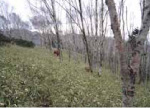
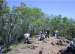
The route along the ridge from the summit takes climbers back into Erman's birch forest and bamboo grass. This vegetation grows due to an isolated area of non-peridotite ground stemming from the presence of a geological fault running between Mt. Pinneshiri and Mt. Apoi. Caution is needed here, as the trail is not easily visible.
Approx. 1 hr. 30 min.
Mt. Yoshida B9Geological
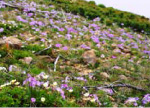
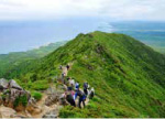
A while after resuming their ascent from the halfway point between Mt. Pinneshiri and Mt. Yoshida, climbers come across roped-off flower fields along the trail and proceed along the flat ridge among colorful alpine flowers. The arrival at Mt. Yoshida is often a good opportunity for lunch.
Approx. 50 min.
Mt. Apoi summit B6Ecological
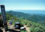
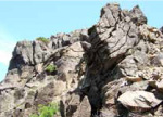
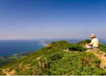
Climbers pass the area's rugged peridotite tracts to reach the final destination along the ridge - Mt. Apoi. People often give thanks at the small shrine there for a safe journey so far before descending along the Mt. Apoi trail with panoramic views of the Pacific Ocean.
Approx. 30 min.
Umanose B5Geological
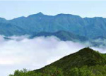
The route up to the Umanose area provides views of flowers, the Pacific Ocean, the scenic Hidaka coastline and possibly even a sea of clouds depending on weather conditions. Care is needed during the descent from this point, as fatigue may start to set in.
Approx. 30 min.
Fifth-stage mountain lodge B1Ecological
A walk down the steep slope from Umanose can be hard on the knees. Rest well before resuming the descent toward the final goal.
Approx. 1 hr.
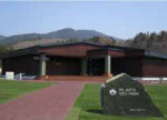
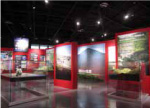
Mt. Apoi Geopark Visitor Center
The visitor center provides information on Mt. Apoi and other aspects of Samani's geology, natural environment, history and culture. (Time required: 30 minutes)
Mt. Apoi Geopark Visitor Center
| Open | April - November |
|---|---|
| Closed | Open daily |
| Hours | 9:00 - 17:00 |
| Admission | Free |
| Tel. | +81-146-36-3601 |
●A Hokkaido Government ordinance restricts access to certain areas of Mt. Apoi to protect threatened animal and plant species. In these areas, entry into zones other than trails without prior authorization is prohibited.