


- HOME
- Living with earthquakes and tsunamis
Living with earthquakes and tsunamis
Japan, an earthquake-prone country
Source: "Geography and Geological Environment of the Japanese Archipelago" on the website of the Japan Geotechnical Consultants Association (JGCA)
Geoparks are places where visitors can explore the formation of the Earth through visible landforms and geological features. Understanding the structure of the Earth in Japan, however, requires recognizing the essential role that natural disasters play
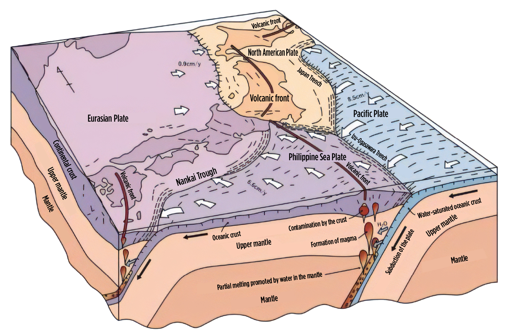
The Japanese archipelago is uniquely situated at the convergence of four tectonic plates--the Pacific Plate, the Philippine Sea Plate, the Eurasian Plate, and the North American Plate--that interact in complex ways. As a result, earthquakes occur frequently. Furthermore, parts of one of the oceanic plates that subduct beneath the Japanese archipelago melt into magma deep underground. This magma then erupts to form volcanoes. Japan is one of the world's most seismically and volcanically active countries.
The Pacific coast of Hokkaido, where Mt. Apoi Geopark is located, has no volcanoes due to its proximity to the trench; however, this region experiences frequent earthquakes.
Damage to Samani Town caused by the Great East Japan Earthquake
The Great East Japan Earthquake of March 11, 2011 originated near the Japan Trench off the Sanriku coast in the Pacific Ocean. A seismic intensity of 4 was recorded in Samani, indicating that the tremor was not particularly strong there. However, several tsunamis struck Samani afterward, with the largest waves exceeding 3 meters. Fortunately, there were no casualties, but the disaster caused damage exceeding 700 million yen, including the flooding of residential floors, the sinking of fishing boats, and damage to seafood processing facilities.
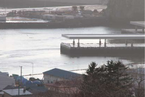
1. After the earthquake, the water receded enough to reveal the bottom of Samani Fishing Port.
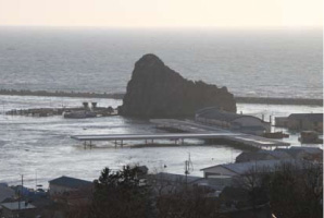
2. About 30 minutes later, the port was hit by a tsunami that surged over the wharf.
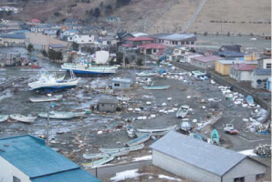
3. Samani Fishing Port on the day after the earthquake: Boats lie overturned and fishing gear is scattered around.
Tsunami tendenko
Tsunami tendenko is a maxim handed down in the Sanriku region of northeastern Japan. It means that "If a tsunami hits, each person should evacuate immediately on their own without caring about others."
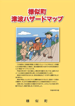
In light of the Great East Japan Earthquake, Samani Town created a tsunami hazard map based on the Hokkaido Government's predictions for the largest possible tsunami. This map clearly indicates the expected reach of the tsunami, evacuation sites, and evacuation guidelines, including a list of essential emergency items. In the event of a tsunami, there is no time to go home to retrieve belongings; you must flee at once to higher ground, with each person acting on their own judgment (tendenko).
It's essential to make a habit of identifying the high ground you should aim for and the routes to get there, so that you can act without hesitation in an emergency.