


Hidaka Yabakei Area
*Click a site name to more information.
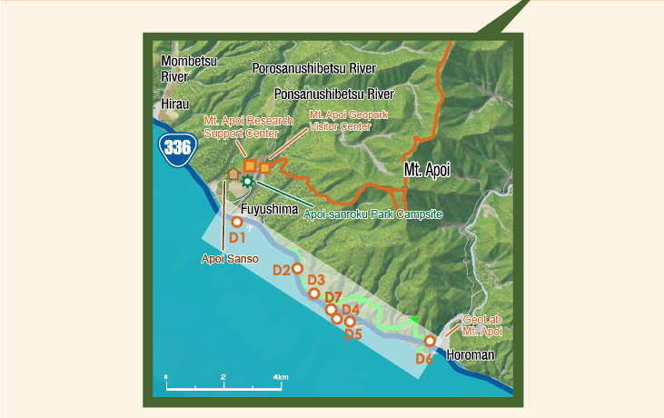
Area D Hidaka Yabakei Area
- D1Geological
- Ana-iwa in Fuyushima
- D2Geological
- Fault at the Higashi Fuyushima Tunnel
- D3Geological
- Metagabbro at the Kotoni Tunnel
- D4Geological
- Taisho Tunnel
- D5Geological
- Geological fold at the Ruranbetsu Tunnel
- D6Historical
- Samani Mountain Path and Wasuke Jizo
- D7Geological
- Former Plate Boundary at the Fuyushima Ooma
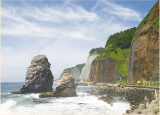
Hidaka Yabakei is a 7-km stretch of precipitous cliffs along the coast of the Pacific Ocean, into which the foot of Mt. Apoi plunges. It is believed to mark the place where the Eurasian Plate and the North American Plate once collided. Part of the boundary (the Hidaka Main Thrust) between the plates remains in this area.
Located at the southern end of the Hidaka Mountains along with National Route 336 (also known as the Golden Road) in Erimo Town, this area used to be notoriously difficult to pass. The Samani Mountain Path was built on the cliffs around 200 years ago to facilitate passage, and is now used as a footpath. At the bottom of the cliffs, high-quality Hidaka Kombu kelp (also known as Mitsuishi Kombu or Laminaria angustata Kjellman) grows on nutrients from the region's peridotite. Surf boats harvesting kelp and locals sun-drying the crop are typical summer scenes in this area.