

Blog
2021.12.22
2nd Online Learning Course with Himeshima Junior High School
On November 1st, we held an online learning course about kelp harvesting in Samani for the Himeshima Junior High School 1st year students in the Oita Himeshima Geopark. This activity is part of the student's "Himeshima Hijiki Branding" education. The online session was held at Mt. Apoi Geopark Visitor Center, where a Samani kelp fisherman came to talk to the students about what it's like to harvest kelp and answer their questions. The students were surprised by the different ways you can eat kelp and how it's harvested from the ocean.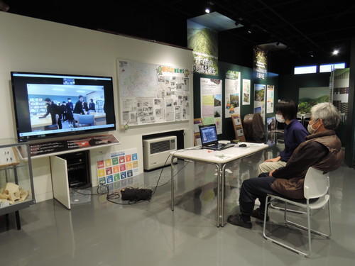
A short article was included in Samani's monthly PR publication.
http://www.samani.jp/koho/ (Japanese Only)
I, myself noticed several new things about Hidaka Kelp and the whole process after overseeing both learning sessions. Particularly when it comes to why Hidaka Kelp thrives in this region and why it's so delicious. A couple of topics that stood out to me were how the natural land features (shape of ocean floor and climate) affect kelp growth and about the history of harvesting kelp. Before the Japanese people migrated to Hokkaido the indigenous Ainu had been harvesting kelp for some time and set a precedent for the branding of Hidaka Kelp. I hope to continue to unfold the story of how the landscape is connected to ocean products by interacting and talking more with the locals. (K)
2021.11.29
Removing Mt. Apoi's Deer Netting
On Tuesday, November 16th we removed some of the anti-deer netting on Mt. Apoi. It was very cold that day and it even hailed. The wind above the 7th Station was quite strong.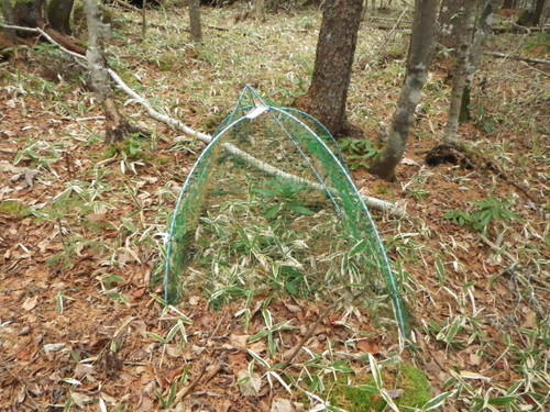
The deer nets were installed by the Rakuno Gakuen University and the Mt. Apoi Fanclub in 2011. 55 nets were setup in order to survey how the Ezo deer affect the vegetation on Mt. Apoi. Today we had four people split into two groups take down the last 15 nets. Thank you very much for your hard work.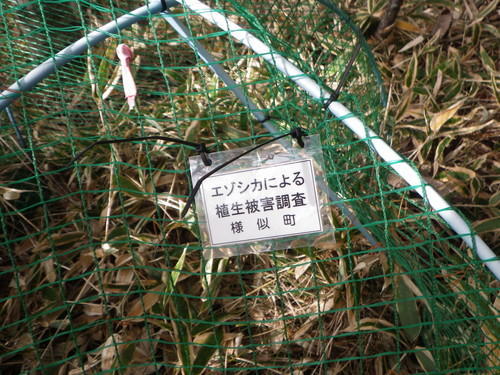
This net was used for I or S's graduation research/doctorate research and teacher S's vegetation survey. The survey was designed to compare the vegetation in the covered and non-covered spaces and reveal the impact that the Ezo deer have on the surrounding area. Only miyakozasa, a variety of bamboo grass, remained inside the nets along the base of the mountain. I was reminded of the surprising effects of the deer and memories about setting up the nets from 10 years ago came rushing back to me.
Members of the Mt. Apoi Fanclub, town curators and survey volunteers have climbed this mountain countless times. Over many years I've been asked by hikers and students alike what the nets are for. But now it's time for the nets to retire. The only ones left are the square and metal nets. Those will probably be removed next April.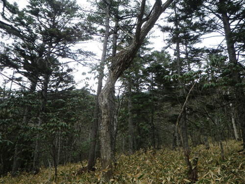
Lastly, I finally found the mistletoe that was a popular topic at a guide meeting in March of last year. (photos above and below)
It was easier to see now that the leaves have fallen. The bushy parts attach to other trees to steal nourishment. In other words, mistletoe is a parasitic plant. When the waxwing bird, most likely the Hokkaido bohemian waxwing, eats the berries, the hard seeds are excreted since it cannot be digested. The excrement is very sticky and strong so it stays where it drops onto the tree trunks. The seeds then adhere to the trees and begin to grow. In other words, the waxwing bird and mistletoe have a mutually helpful relationship. Thanks to T & T for teaching me about mistletoe.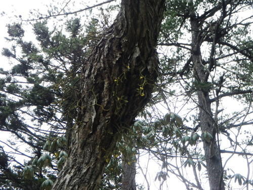
2021.11.15
Clean Up at Cape Enrumu ~A clean ocean for future generations~
On Sunday November 11th, we picked up trash along the coast around Cape Enrumu. The coastal areas of Hokkaido along the Pacific Ocean side have been experiencing a red tide event, and the evidence of this was found in the area as well. We found bleached sea urchin shells all along the beach. Let's do our best to leave a clean ocean and beaches for future generations.
Our group of volunteers collected 310 kg of trash (not including industrial waste) from the coastline. Around 55 volunteers gathered from as far as Urakawa and Obihiro to join the Samani towns people, Hidaka Credit Union, firefighters, townhall employees, and geopark guides. Thank you so much for all your hard work!
This is actually the 2nd clean up even held at Cape Enrumu. You can read the blog post from the 1st event here: https://www.apoi-geopark.jp/english/blog/index_3.html 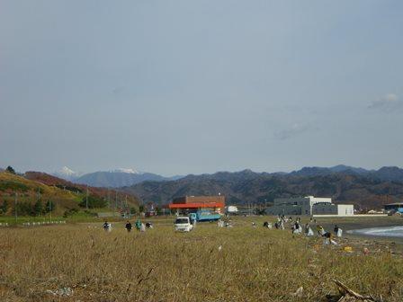
Cleaning up the coast. In the back left you can see the pyramid shaped Mt. Rakko among the mountain, dusted with snow. This month, the wind along the coast has been cold but we were blessed with fair skies and little wind today.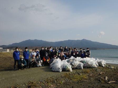
A photo of the volunteers in front of the Mt. Apoi mountain-mass and bags of trash collected.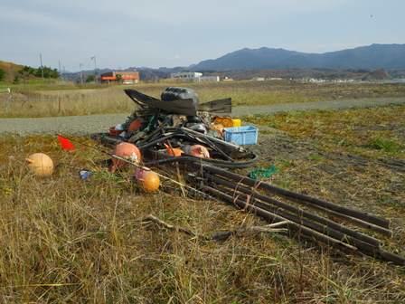
Oversized industrial waste that was collected. Long ropes, plastic buoys, and other fishing industry waste.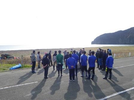
We also learned about how trash crosses the oceans. Some volunteers found plastic bottles that came all the way from China. We plan to organize this even again next year, and hope many of you will volunteer again.
2021.11.06
Rainbows and Fall Colors
On October 23rd, some visitors came to the Visitor Center and I was guiding them around the geopark. Apparently, they are touring all the geoparks in Japan. We were very lucky to encounter a rainbow while enjoying the fall foliage in Shintomi. Here are some photos.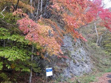
Fall colors at "Shintomi Chert" geosite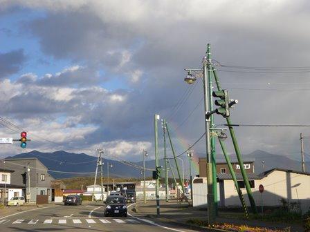
The rainbow appeared right in front of Mt. Yoshida. (Photo taken in Sakae-machi)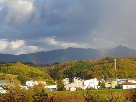
We even saw a double rainbow. The second rainbow appears between Mt. Apoi and Mt. Yoshida. (Photo taken at Sakae-machi's former quarry, facing the Apoi mountain mass)
*The order of the colors differs from the primary and secondary rainbow. The primary rainbow has red on the outside and purple on the inside while the secondary rainbow show purple on the outside and red on the inside. In other words, the colors are flipped.
*The water droplets that make up the secondary rainbow are reflected one time more than the primary rainbow and the light is flipped towards the viewer, which makes it harder to see and the colors are not as vivid.
*The space of sky between the two rainbows, so on the underside of the primary one and above the secondary one, appears darker than the surroundings. This dark area is a phenomenon called "Alexander's Band." I hope to confirm this phenomenon next time.
2021.10.22
~Frost~ Winter is Almost Here
The mountains surrounding Samani are full of autumn color, but this morning there were a few places around town that had frosted over.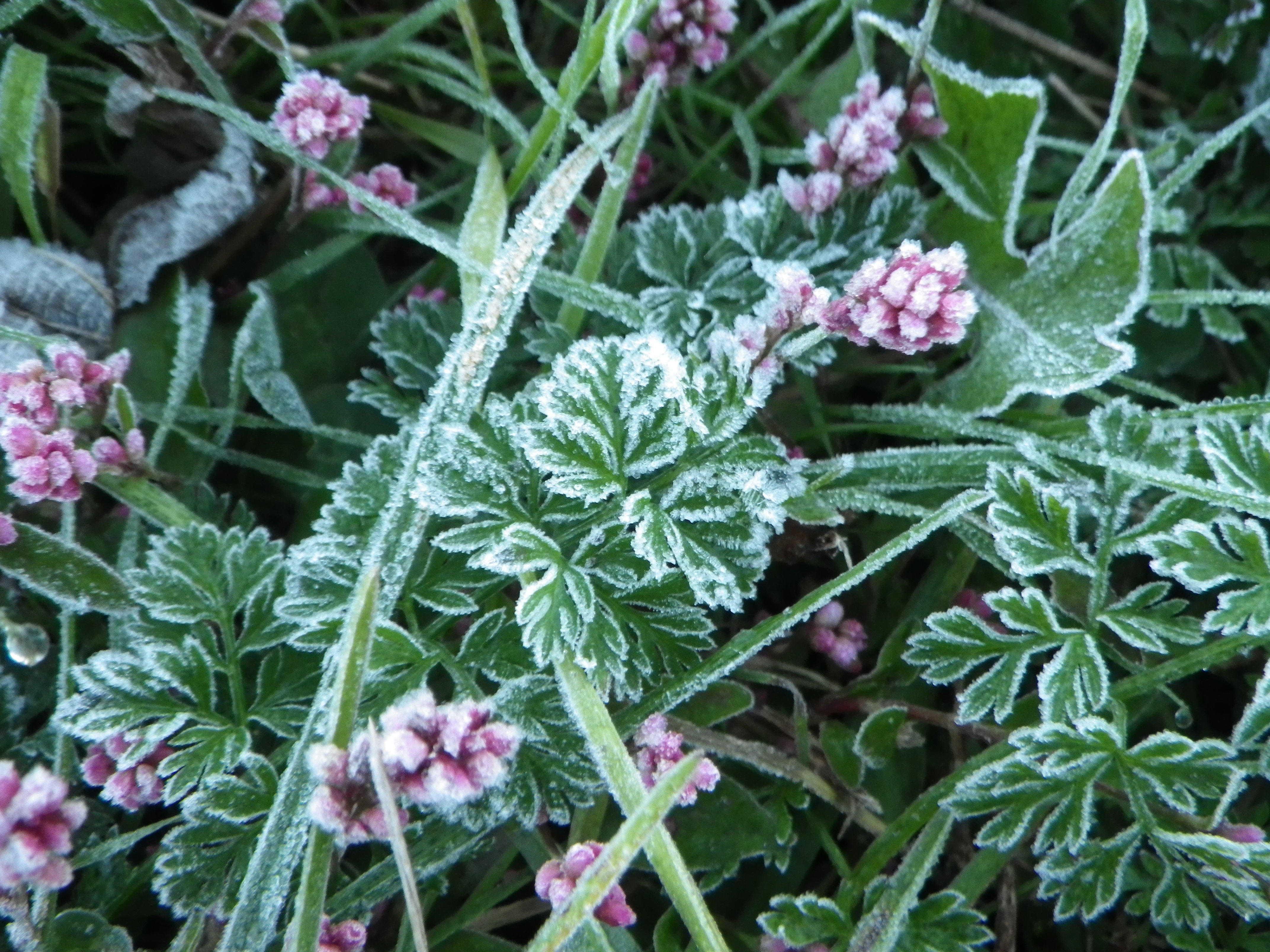
I was told that fairly soon we'll be able to see beautiful "needle ice" in the fields. I've never taken a photo of the needle ice before, so I hope I can see them soon.
Needle Ice: When the temperature reaches below freezing, the water in the ground rises and freezes in thin needle-like columns through capillary action. Needle ice is formed when water is present in the ground, which is a different phenomenon than the sublimation of water vapor in the air that causes frost.