

Blog
2021.10.19
Horoman Gorge Fall Foliage Peak
I went to check out the fall foliage in Horoman Gorge on October 14th. It was perfect timing. The combination of evergreens, and red and yellow leaves mixed together was beautiful.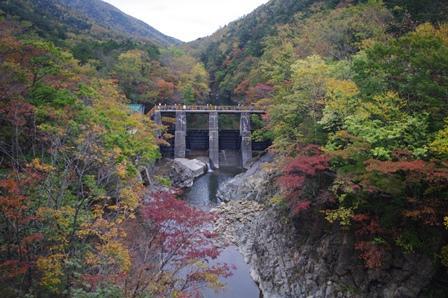 Fall colors at the 2nd Horoman River Power Plant
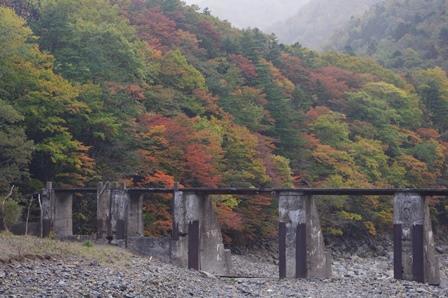 The former power plant
 Viburnum berries
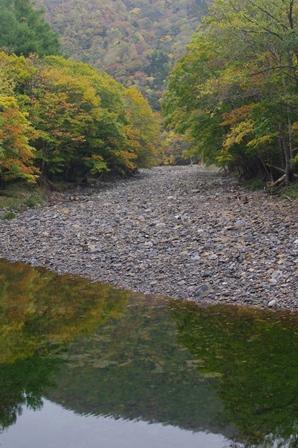 Reflected on the water
The Japanese White Pine can also be found here in the Horoman Gorge at the northmost limit of its habitat, and the Inari Shrine. Be careful while driving but definitely take some time to check out the fall colors.
2021.10.06
Changes in the Ocean
Recently the national news has been reporting on major changes in the ocean, in particular to sea urchin and salmon in the Pacific Ocean around Hokkaido so I would like to share some information about the situation here in Samani.
"Dolphin Washed Ashore"
On Sunday, September 26, 2021, on Samani's election day, the body of a dolphin was washed ashore near the Taisho Tunnel. Usually you would expect a whale, but it was no longer than 4 meters in length and definitely a dolphin. After talking with the locals, they believe it may have washed up a few days' prior as the smell from the dolphin had permeated the surrounding neighborhood.
This reminded me of two things. A Hubbs' beaked whale washed up on the shores of Samani in 2015 and 2018 and researchers came from all across Japan to study it. The second is that the Ainu people offer prayers when whales wash up on the shore, and that practice is being handed town here in Samani.
In the past it was fairly common for whales to appear on Samani shores, and the local people would gather with their kitchen knives and cooking pots in hand.
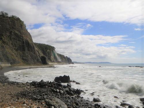 Cape Erimo/Hidaka Yabakei area. Quite a few waves on October 2nd.
"Bleached Sea Urchin and Mui Washed Ashore"
Starting around September 9, 2021, there have been several news stories about dead sea urchin and mui chiton mollusks being washed ashore. There have also been stories on the news and in newspapers about dead salmon being caught in nets along Hokkaido's Pacific coast.
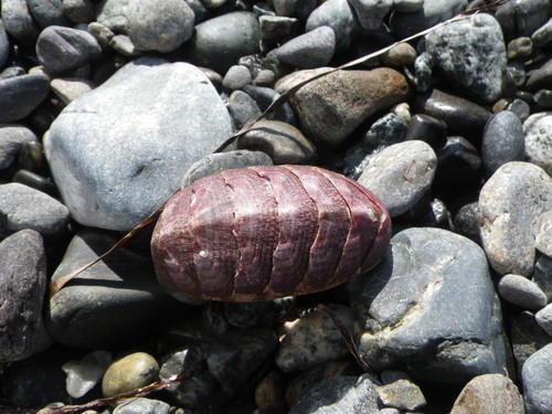 Mui (chiton mollusks) shell
According to the Sept 26, 2021 Hokkaido Newspaper, the ocean water turned brownish-red mid-month, proof that a red-tide has occurred. A red-tide means that a large amount of plankton (karenia & mikimoito) is in the water. In mid-September Erimo, a neighboring town, received a large amount of rain due to a low-pressure system that moved through the area, but it's not clear if that was the cause of the red-tide.
According to the Oct 2, 2021 Hokkaido Newspaper, the Erimo Fishing Cooperative (including half of Samani) lost 1280 salmon and 10 tons of sea urchin. Hidaka Central Fishing Cooperative (including half of Samani) lost 60 salmon. This red-tide all around Hokkaido could be caused by large amount of plankton from western Japan but further observation is needed.
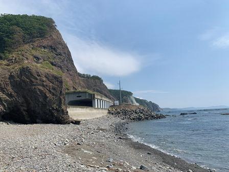
On October 10, 2021, we conducted a survey around the Taisho Tunnel in Samani's Fuyushima area. The coastline here had a different scent to it (most likely due to the dead sea creatures). There were many bleached sea urchins that had lost their spines (mostly Ezo bafun sea urchin), and quite a few mui chiton mollusks. Other things we noticed were intact whelk, mussels with temporary roots attached, and the roots of Hidaka kelp. This could be due to a typhoon or the rising temperatures of the ocean, and although we don't know the actual reason, for now we are documenting our findings. Local fisherman told us that similar occurrences have happened in the past and sea urchin could not be fished for several years after that.
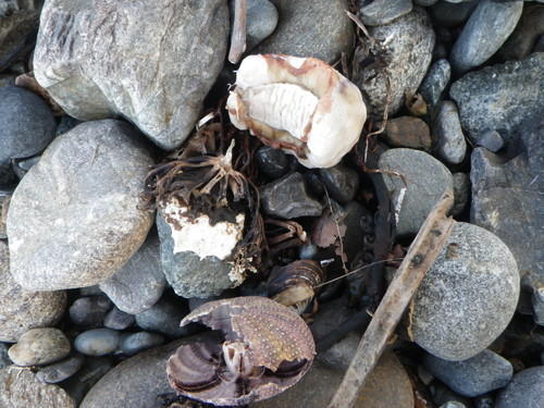 Mui (mussel), sea urchin, kelp root
On Oct 2, 2021, a researcher from Shikoku came to the Mt. Apoi Geopark Visitor Center after surveying Mt. Apoi, so I asked them about the red-tide of the Seto Inland Sea. Red-tides occur frequently in the Seto Inland Sea. In particular, it affects farmed yellowtail. As a native of Shikoku, the damage caused by a red-tide in the open sea is surprising.
We are currently focusing on two different methods in order to get to the bottom of this "change in the ocean" issue. First is utilizing the Three Principal Viewpoints: bird's eye view/fish eye view/bug's eye view. This includes comparing the situation with Shikoku's, searching for the bigger picture, and documenting the current situation. Secondly, by studying the past. We are looking into Samani's past records to uncover new knowledge and viewpoints.
2021.09.21
Tip of Rosoku-iwa Crumbles
The tip of Rosoku-iwa (Candle Rock), one of the characteristic sights of Mt. Apoi Geopark and Samani, collapsed. It lost its candle-like shape!
We believed it collapsed sometime between September 18th and 20th after it rained all day on September 17th. Here is what it looks like now compared to photos from 5 years ago.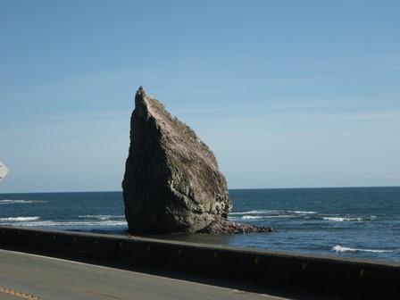
Sept 20, 2021. You can see the collapsed rubble to the bottom-right of Rosoku-iwa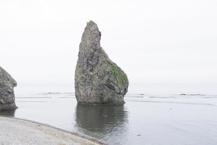
June 6, 2019
Rosoku-iwa and the Shiogama (Salt Pot) Tunnel are called "joints" which include lots of fissures in the rock and we think that the collapse happened along one of these fissures. (Rosoku-iwa is located next to Shiogama Tunnel)
I was surprised by the amount of rubble the collapse created. It's a statement to the fact that Rosoku-iwa and Oyako-iwa (Parent and Child Rocks) are large rocks formed by erosion and weathering, and also serves as a reminder to be more aware of potential landslides due to erosion.
The view of Rosoku-iwa from the Oyako-iwa Fureai Beach has changed as well. Let's look at some photos from the past.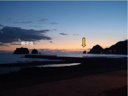
August 25, 2013, Evening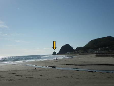
September 20, 2021
Since 2003, Rosoku-iwa and Shiogama Tunnel have had two other partial collapses:
- After the Tokachi Okichi Earthquake (Magnitude 8.0) on Sept 26, 2003, the tip of Rosoku-iwa and part of the Shiogama Tunnel (ocean-side) collapsed. (Cited: Kouhou Samani)
- In February 2019, part of the Shiogama Tunnel (ocean-side) collapsed. (Cited: Chikubetsu Kikakuten Utoma)
2021.09.17
Samani Elementary 5th Graders' Fieldtrip to the Visitor Center
On September 7th, 24 fifth grade students and their teacher visited the Mt. Apoi Geopark Visitor Center to learn about the various rocks that can be found around Samani. Hokkaido is still under a State of Emergency due to COVID-19, so there were several preventative measures in place during this field trip.
The students prepared questions before they came, and I did my best to answer them while showing them around the facility. The students learned all about fossils, limestone, porphyrite, peridotite, gold dust and more.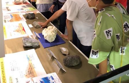
One of the students asked, "How big is peridotite?" So, we went outside to see a large peridotite specimen and to enjoy the surrounding scenery. (Photo below)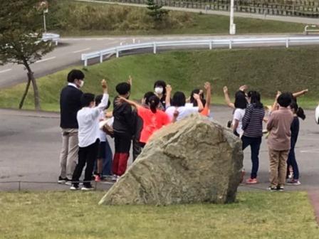
I asked the students how they came up with their questions and everyone was able to explain their thought process. The students were well behaved and took turns viewing the various rock specimens in the Visitor Center.
2021.09.14
Oita Himeshima Geopark's JH School "Hidaka Kelp" Online Learning Course
For the first time, we held an online learning course from a kelp drying bed in Hokkaido, Samani's Fuyushima district for the Himeshima Junior High School students in Oita prefecture. The village of Himeshima is also part of Oita Himeshima Geopark.
The Himeshima JH 1st graders have been learning about the branding of Himeshima Hijiki and they wanted to compare it to Hidaka Kelp. We received a request for the online learning course in order for the students to connect with a kelp fisherman. During the planning stage, however, it was then requested that we expand the topics to also include kelp harvesting and drying, Ainu place names, and peridotite, a rock found deep within the earth.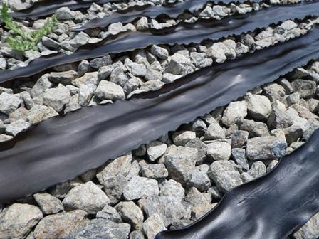 Sun dried Hidaka Kelp
This was our first attempt at such a project and it required a large amount of preparation. We asked the geopark guides/staff and local fishermen for advice, all while testing out the broadcast connection, writing a script, planning for inclement weather, learning how to use various equipment and coming up with effective explanations.
The learning course was held on August 30th. It was broadcast from an area next to the Taisho Tunnel in Samani's Fuyushima district. It was a bit windy, as you can see from the photos, but otherwise we were blessed with fair weather.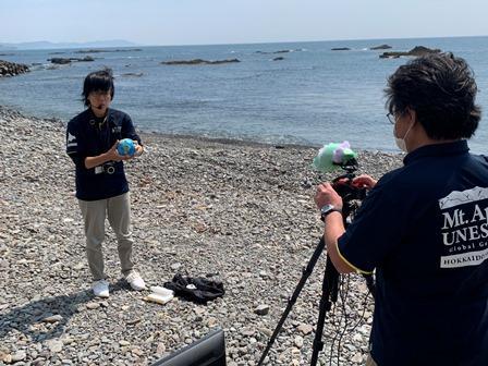
Before holding the online course, we sent kelp and peridotite samples to the Himeshima JH students to have on hand while watching the broadcast. The students were quite surprised then they unfurled the rolled-up kelp to its normal 2-meter length.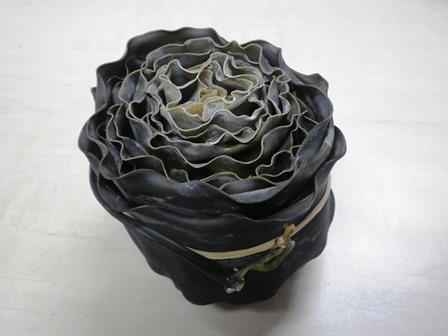 Is this a rose!? It's just rolled-up kelp. It even included the root.
We wanted to show how kelp is harvested and dried, but were unable to do so. Kelp is only harvested during a short period of time, just 20 days out of the year. You might say you'd be lucky to actually see it happening. The ocean waves were too high for harvesting kelp on the day of the learning course. After we showed the students the drying beds and the surrounding scenery, they watched a video that introduced kelp harvesting, filmed by the Samani PR Division. The students were surprised to find that everything is done by hand and that the boats will go out to harvest and pull in kelp more than 5 times in a day.
Here is a link to the kelp fishing video. Please watch it if you are interested in how Hidaka kelp is harvested from the ocean.
https://www.youtube.com/watch?v=0Adwc9IsQmI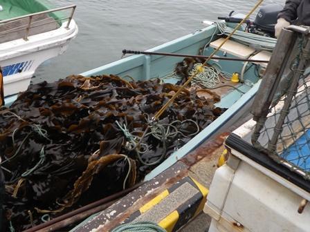 Kelp harvesting (July 16, 20021)
We received some commentary from the students about how it's fun to learn something that you never knew. They were also impressed that we could connect to each other via the internist regardless of how far Oita prefecture is from Hokkaido.
The students also had several questions concerning resource management for Hidaka kelp, how the earth and kelp are connected, the ecology of kelp, other Samani local specialties, and about the 2nd year harvesting of kelp. You could tell that they were paying close attention and showed lots of interest in the subject matter.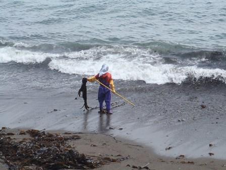 Hand-picked kelp (July 19, 2021)
Here are a few things that we realized after the learning course was over:
1) It's easier to understand when the materials are at hand
2) Use easy to understand videos that can also be used as supplementary materials in case of bad weather
3) This led to a rediscovering of Hidaka kelp
4) Sometimes it's hard to hear with words alone
We were worried that it might not go well, but in the end, it was quite fun!
This initiative was also shared on the Oita Himeshima Geopark homepage, please check it out.
https://www.himeshima.jp/geopark-news/geopark-topics/r30830gakushu/