
Blog
2025.11.01
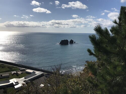
Fall Colors at Horoman-kyo Gorge
On Oct 31st, I went to check out Horoman-kyo Gorge.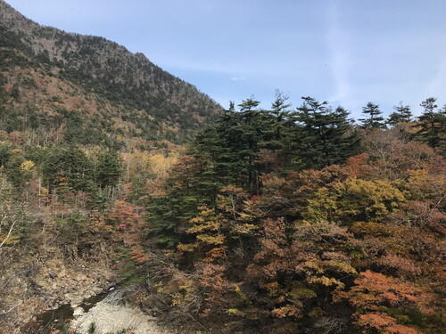
Area around the Japanese White Pine Monument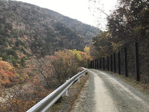
The road near the Japanese White Pine Monument. No snow just yet.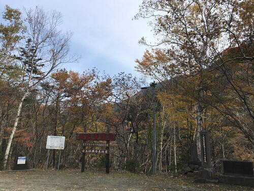
In front of the Japanese White Pine Monument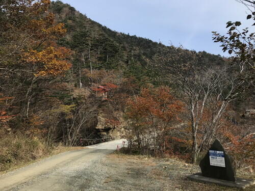
Fudo-no-sawa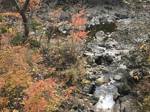
The junction of Fudo-no-sawa and Horoman River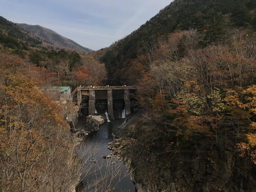
Second power plant dam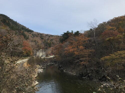
Third power plant, near Inari Shrine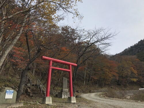
Inari Shrine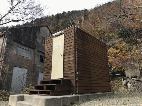
The bio-toilet. We just finished repainting it.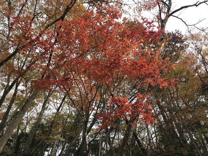
Maple trees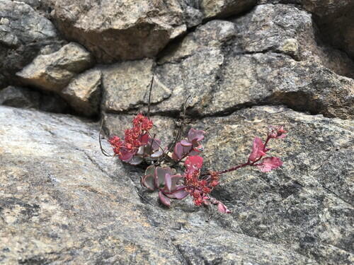
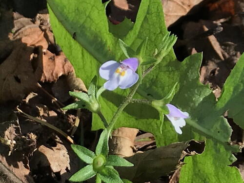
Hidaka-misebaya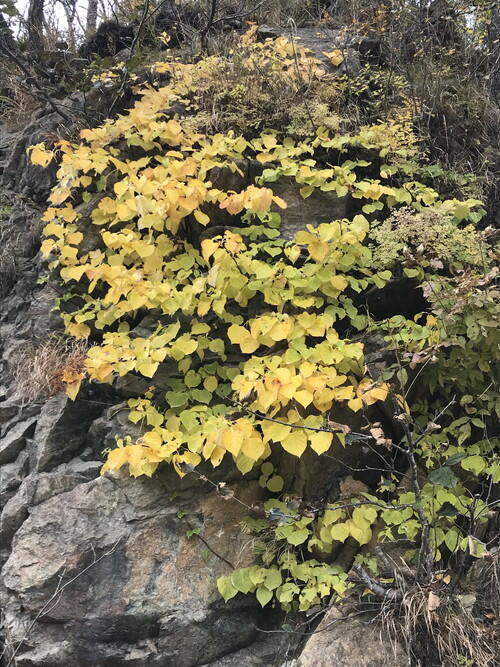
Fall colors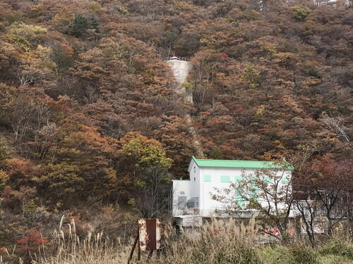
Second power plant
2025.10.30
Apoi College "Raccoons: Knowledge and Prevention"
On Oct 30th, I attended the Apoi College lecture, "Raccoons: Knowledge and Prevention." About 60 people attended, which indicated a high level of interest. Recently, there's been a surge in the number of raccoons captured in Samani Town. Raccoons are not native to Samani, so it's essential for residents to understand them and take measures to prevent damage from raccoons. This lecture covered the ecology of raccoons and preventative measures. The Apoi College speaker was Professor Toru Ikeda of Hokkaido University.
▼ History of the raccoon's arrival
Raccoons were first spotted in Hokkaido in 1977, and they have spread throughout the entire prefecture, found in 167 municipalities as of January 2025.
▼ The Ecology and Social Impact of Raccoons
Raccoons are nocturnal animals with highly developed senses. They reproduce faster than even the Ezo deer, which birth only one offspring per year; whereas raccoons, on average, birth up to four per year. Problems caused by invasive species include damage to commercial crops (primarily sweet corn and strawberries in Samani), trespassing, the transmission of diseases, the displacement of native species through competition, and the reduction of native species populations through predation.
▼ Raccoon Prevention Measures
Raccoons are highly intelligent and curious animals, and they show a strong interest in traps, so instead of avoiding the traps, it makes raccoons relatively easy to capture. When trying to control raccoon populations across large areas, establishing a social control method is more pressing than addressing technical or strategic challenges. There are various approaches to dealing with traps. Many impressive methods are emerging from New Zealand.
By tracking CPUE (Catch Per Unit Effort) from recorded trappings, we can estimate population density in trapping areas. This allows us to estimate the total population size. In order to effectively reduce raccoon numbers, setting the target capture rate at half the population size is sufficient. This approach offers a viable solution through the application of data-driven scientific insights.
The common box traps that are used can be difficult to maintain as they require daily inspections, and there was also a video explaining how to use the nest-box traps.
▼ Raccoon Prevention Measures in Samani
According to Samani's 2021 Wildlife Damage Prevention Plan, by attending a raccoon capture training session and obtaining a Raccoon Control Certificate, anyone can safely and legally capture raccoons without a hunting license. I'm not sure how long the certificate is good for, possibly only for one year.
▼ Conclusions
In Erimo Town, the local Town History Museum shared an example of raccoon capture efforts near Lake Toyoni. The lakeshore is home to rare native species that require conservation; it is also a habitat for brown bears and features a well-known nature trail for tourists. Nest-box traps are often used to capture raccoons in this area.
Key points for effective raccoon population control include early detection, swift countermeasures, and cooperation from residents. Damage prevention starts with awareness of the issue. The lecture emphasized the importance of covering a large area with these countermeasures.
2025.10.10
Mt. Kannon in Autumn
I visited Mt. Kannon on Thursday, October 9th.
I held my hand in front of the wind cave and felt the warm air. It's around this time of year that the warmest air flows through the cave. 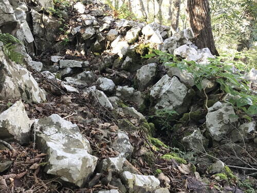
It's starting to look more like fall on Mt. Kannon, and I found lots of seeds and berries.
Korainantenshou (Arisaema peninsulae). It becomes a female plant when grown in nutritious soil.
The stem-like parts are pseudostems, the lower sections of leaf stalks, featuring a mottled pattern resembling that of a venomous snake, like the Japanese pit viper.
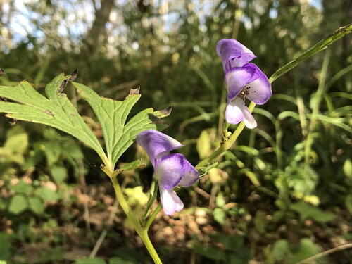
I think this is the Ezotorikabuto, a poisonous plant.
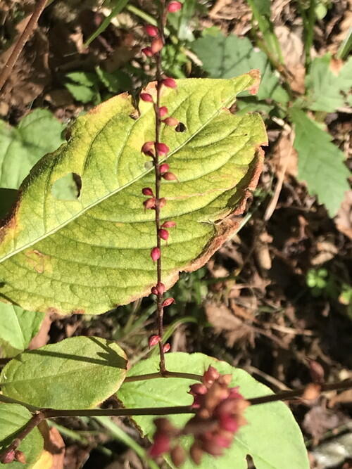
Mizuhiki. The upper part is red, while the lower part is white.
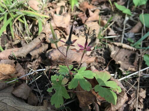
Gennoshokou. The fruit is rod-shaped and when ripe, it splits into 5 sections at the base to disperse the seeds
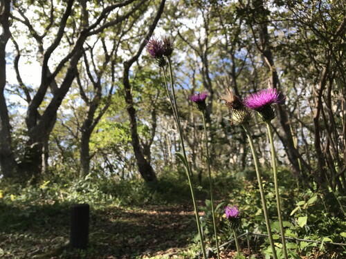
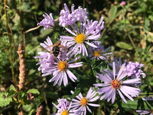
Aomori-Thistle. This is the flower that I saw the most of. One of the characteristics of this flower is that it faces upward.
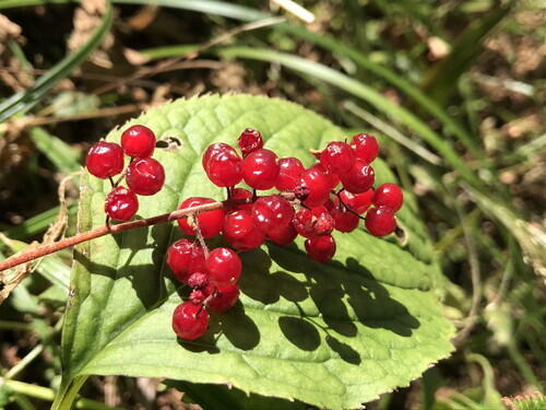
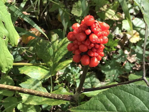
Red berries of the Yukizasa. I remembered that you can simmer and eat the berries; they are delicious with no bitterness.
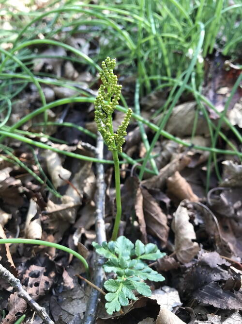
Ezo-fuyunohana-warabi
These are a type of fern. What look like flowers are actually called fertile fronds, pouches that contain spores.
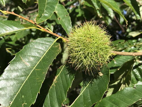
Chestnuts. Now I'm craving chestnut rice.
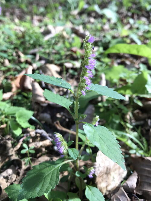
Naginatakoju, from the mint family. It can be used for tea.
Black nightshade, from the nightshade family.
Yuzengiku. It resembles edible chrysanthemums.
Views from the Mt. Kannon observation deck
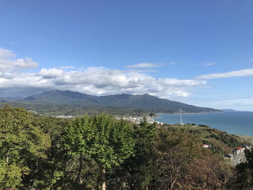
Mt. Apoi
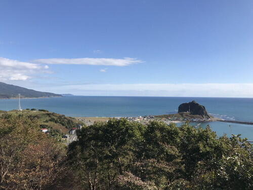
Cape Enrumu
Oyako-iwa (Parent & Child Rocks)
2025.08.08
"Aim for the Mantle! From Peridot to Ultra-Deep Sea Voyages" Lecture
On Aug 7th, we hosted a lecture, "Aim for the Mantle! From Peridot to Ultra-Deep Sea Voyages," by Professor Katsuyoshi Michibayashi from Nagoya University, Graduate School of Environmental Studies, Department of Earth and Environmental Sciences, Geology, and Geobiology.
The lecture included the following: 1) characteristics of the Horoman peridotite complex and peridotite found in ocean areas, 2) the exploration and research of the ultra-deep sea.
When comparing the Earth's crust and mantle by volume, the mantle is by far more extensive. However, in terms of value, the crust holds greater significance. Its familiarity often makes us overlook its true worth. While the mantle is vast, it is rarely exposed at the surface. One of the few places in the world where the mantle is visible is Samani Town.
Fresh (non-serpentine) peridotite rock has been collected from depths of around 9,000 meters in the Tonga Trench. Professor Michibayashi showed some very colorful photographs of thin sections of the rock samples viewed under a polarizing microscope.
It was announced that next year, from August 25-28, the Horoman Mantle Drilling and Carbon Injection International Workshop will be held in Samani. We also heard about the potential of hydrogen energy in peridotite complexes.
Reference link: https://www.icdp-online.org/projects/by-continent/asia/horoman-dc-japan/
We'd like to express our profound thanks to Professor Michibayashi for an amazing lecture!!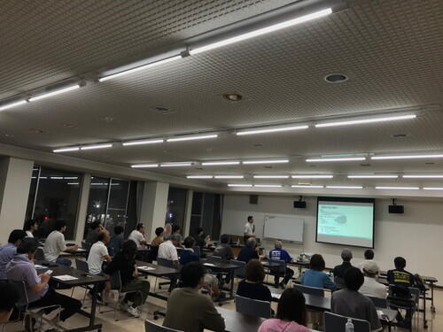
2025.08.06
Visitor Center Summer Event: Making Wind Chimes
We are currently prepping materials for a summer event at the Visitor Center: windchime making.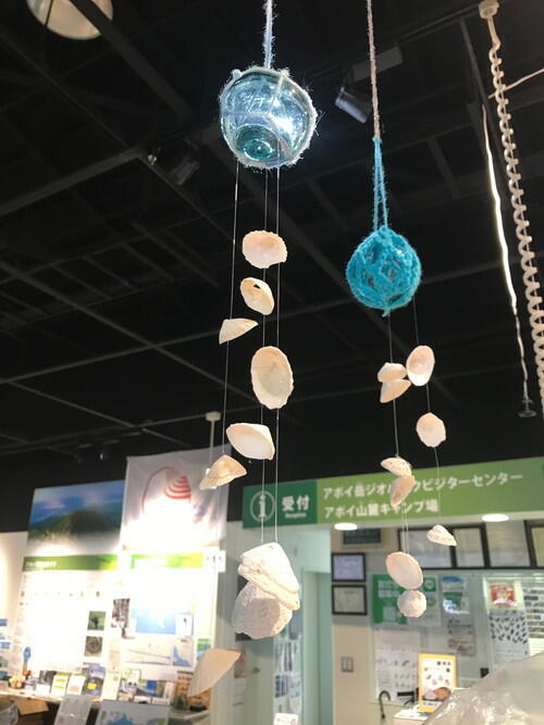
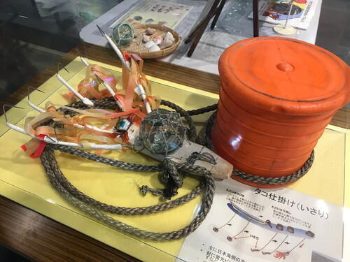
Participants can choose from a variety of shells to make the wind chimes. 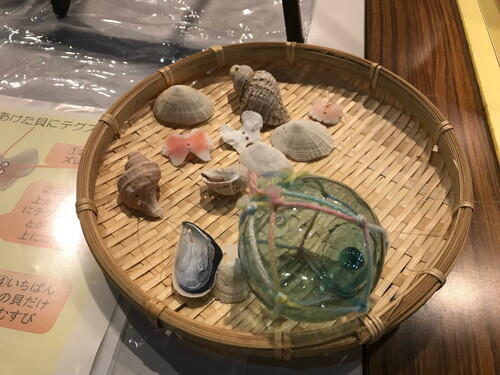
We also set up a small exhibit for visitors to see how the old glass floats were used in fishing. I borrowed a fishing device used for octopus called an "isari," from a local. In Samani, octopus traps are commonly used, but on the Sea of Japan side of Hokkaido, these "isari" are more commonly used.