

Blog
2025.08.04
8/3 Hokkaido University Field Trip
On August 3, 28 members from Hokkaido University's School of Engineering visited our town on a field trip.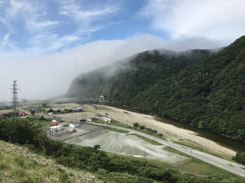
We observed peridotite in the Horomankyo Gorge. 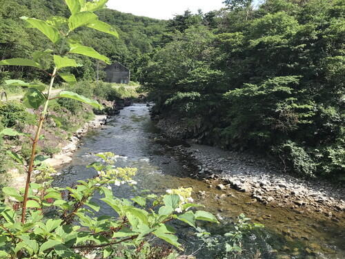
Horomankyo Gorge is lush and green during summer.
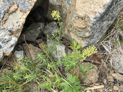
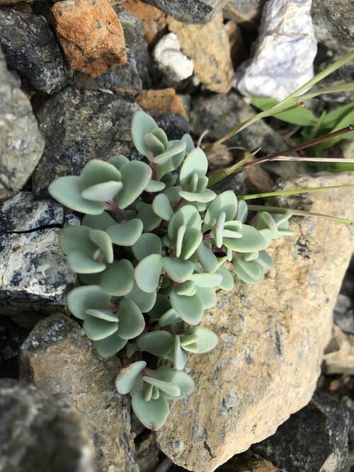
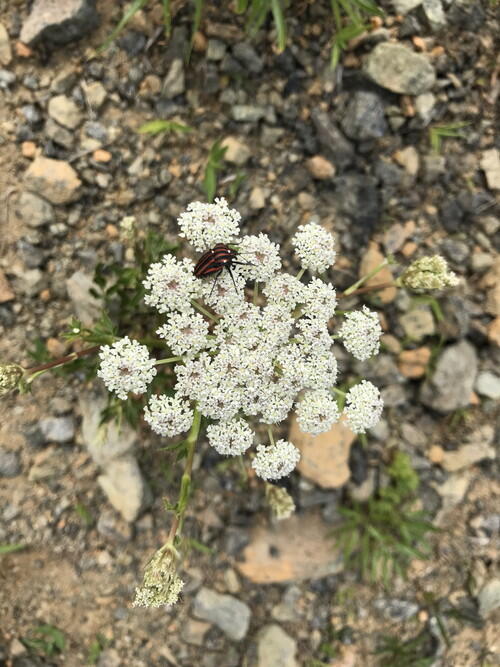
Here are some flowers that we found along the way. 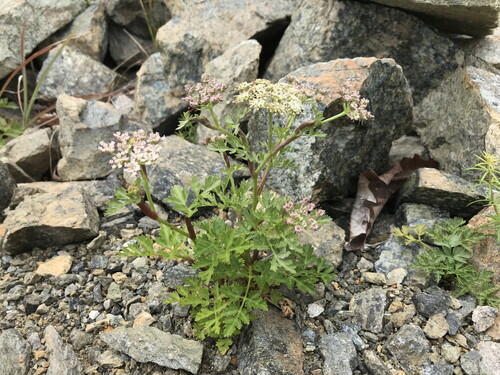
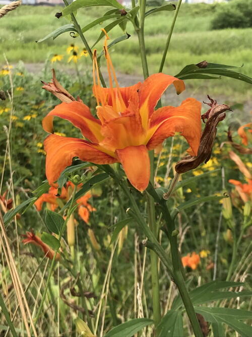
Some orange daylilies were blooming near the Fire Festival grounds. 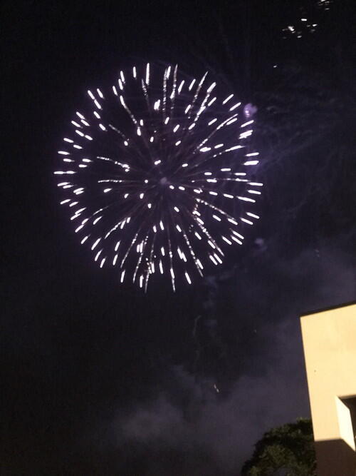
The Fire Festival fireworks display.
2025.08.01
Kamchatka Peninsula Earthquake and Tsunami - July 30
*This blog post is a brief report on the situation here in Samani.
Wednesday, August 30, 8:25 AM
A massive magnitude 8.8 earthquake struck off the southeastern coast of Russia's Kamchatka Peninsula, prompting the Japan Meteorological Agency to issue a tsunami warning along the entire Pacific coast, from Hokkaido to Wakayama prefecture.
The earthquake epicenter was located at a depth of 21.5 km (USGS).
9:40 AM
A tsunami warning was issued for the coastal areas along the Pacific Ocean, including Samani.
Evacuation orders issued for the following areas: Utoma, Nishimachi, Minatomachi, Honmachi, Sakaemachi, Kaishomachi, Odori, Nishikimachi, Midorimachi, Hirau, Fuyushima, Horoman, Asahi
Evacuation Centers: Hoyoji Temple, Sobiraso Retirement Home, Okada Community Center, Tashiro Research Center, Tojuin Temple, Sumiyoshi Shrine, Hokyoji Temple, Chikyoji Temple, Apoi Sanso, Asahi Community Center, Nishimachi Fire Department Construction Site Office
10 AM
Use of the Mt Apoi Foothill Family Campground, Oyakoiwa Fureai Beach Campgrounds was suspended due to the tsunami warning, and will only resume after the tsunami warning is lifted.
That evening
Overnight Evacuation Centers: Hoyoji Temple, Tojuin Temple, Sumiyoshi Shrine, Hokyoji Temple, Chikyoji Temple, Apoi Sanso
8:45 PM
The tsunami warning was downgraded to a tsunami advisory, and therefore, the evacuation orders issued for the town were lifted.
Thursday, July 31, 4:30 PM
The tsunami advisory was lifted.
The Mt. Apoi Foothill Family Campground and Oyakoiwa Fureai Beach Campground reopened.
----------
Observed Tsunami Height
Tsunami waves reached a wide area from Hokkaido to Okinawa.
- Kuji Port, Iwate 1m30cm
- Tokachi Port in Hiroo, Hokkaido: 70 cm at 1:18 PM on July 31. The first wave was recorded at 10:32 AM on July 30.
- Shoya, Erimo, Hokkaido: 60cm at 9:14 PM on July 30
- Urakawa, Hokkaido: 20cm at 4:06 PM on July 30. Unable to determine when the first wave occurred.
https://www.jma.go.jp/bosai/map.html#6/40.772/144.492/&elem=info&contents=tsunami
----------
Weather Conditions
At the observation site in neighboring Urakawa, the high temperature was 25.7 degrees Celsius and the low temperature was 20.4 degrees Celsius.
The weather was cloudy with some sunny intervals. Humidity was around 83-100%.
----------
The Earthquake
▼Reference: https://scienceportal.jst.go.jp/gateway/clip/20250731_g01/index.html
The Kamchatka Peninsula, where the massive earthquake occurred, is located where the Pacific Plate on the ocean side is subducting beneath the North American Plate on the land side. This earthquake is the same trench-type earthquake that caused the 2011 Tohoku-Pacific Ocean Earthquake, which triggered the Great East Japan Earthquake and Tsunami.
According to the US Geological Survey (USGS), the Pacific Plate is slowly moving northwestward at a rate of 80 mm per year relative to the North American Plate in this area. This massive earthquake was a reverse fault earthquake caused by pressure building up in the northwest direction and then rebounding.
The USGS has stated that this massive earthquake is the largest in the world since the Tohoku Pacific Ocean Earthquake, and ranks among the top 10 largest earthquakes to occur worldwide since 1900. Before this earthquake, there were 50 earthquakes with a magnitude of 5.0 or higher, including a magnitude 7.4 earthquake on July 20 and three magnitude 6.6 earthquakes.
----------
Warnings
Residents and visitors were continuously warned to stay away from rivers and coastlines, and to evacuate to higher ground until the tsunami warning was lifted. These warnings were also posted on road information signs along the road.
----------
Road Closures and Restrictions
▼ Expressways
E5 Hokkaido Expressway (Onuma Koen IC to Tomakomai Chuo IC)
E5 Hokkaido Expressway (Tomakomai Chuo IC to Chitose IC)
E63 Hidaka Expressway (Tomakomai Higashi IC to Numanoe-nishi)
▼ National Roads
There were some traffic restrictions in place.
Those who could not pass through Kogane Road had to take a detour via the Tenma Kaido. Between Samani and Urakawa, there were some restrictions on the coastal national highway, but some people took the detour through the mountains.
----------
Previous Tsunami at Kamchatka Peninsula
- 1952 Kamchatka Peninsula Earthquake
- Occurred at 1.58 AM on November 5
- 2 magnitude (Earthquake Observatory)
- The earthquake was felt in several locations along the Pacific coast from Nemuro to Hitachi. Two to five hours after the earthquake, 1-2 meter high tsunami waves struck along the coasts of Hokkaido and Honshu, coinciding with high tide at 5 PM and causing minor damage.
- The tsunami was larger along the Sanriku coast than in Hokkaido. In Hokkaido, a tsunami of up to 1 meter hit the coast, causing flooding in low-lying areas and damaging houses in Hamanamura Kiritaka, Kushiro, Hakodate, and other areas. Along the Sanriku coast, the tsunami was larger than that caused by the Tokachi-oki earthquake on March 4, 1952, reaching wave heights of 1 to 3 meters. As a result, houses were flooded, fields were submerged, and port facilities, as well as seaweed and oyster farming facilities, fishing boats, and fishing gear, were damaged or lost.
2025.07.21
Geological Observations at Mt. Apoi with High School Students
We recently hosted a group of 45 students from Sapporo Kaisei Secondary School and Sapporo Asahigaoka High School to participate in a geology field trip to Mt. Apoi.
The theme for the two-day trip was "Peridotite and Movements of the Earth."
On the first day, we visited Peridotite Plaza, the former plate boundary, Horoman River, and GeoLabo, the Mt. Apoi Geology Research Lab. On the second day, we went to Mt. Apoi. We discussed the relationship between geology and plants, observed rocks, including peridotite, and explained the geological formations surrounding Mt. Apoi. The students asked more questions than we anticipated! We strived to show the students as many aspects as possible, including plants and insects. 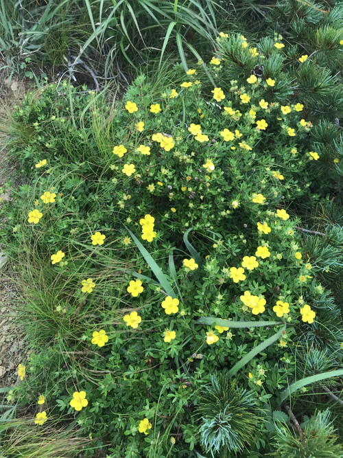
The yellow flowers really stood out on this day. We explored the differences between Kinrobai (pictured) and Samani-otogiri flowers.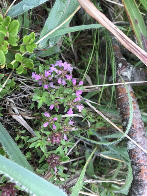
The first flowers we spotted were the Ibukijakoso. 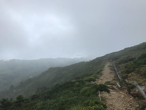
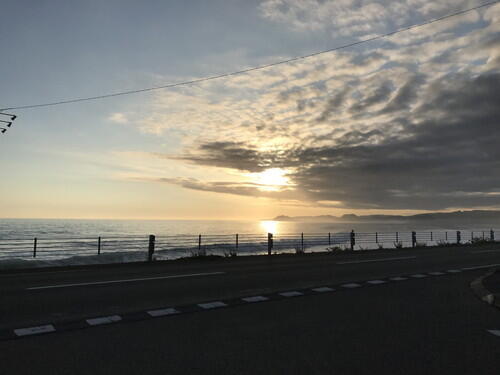
It was foggy around Uma-no-se, but we could still see the ocean. The weather was quite humid, but at least it was not scorching hot.
2025.06.30
Touring Mt. Apoi Geopark on an E-MTB
On June 28 (Sat), the KanxKan Lectures and Apoi College held a joint event to tour Mt. Apoi Geopark on electric mountain bikes (E-MTB).
When I was checking the route the morning of the tour, Oyako-iwa looked whimsical sitting above the mist. 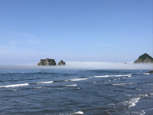
We started with safety training. 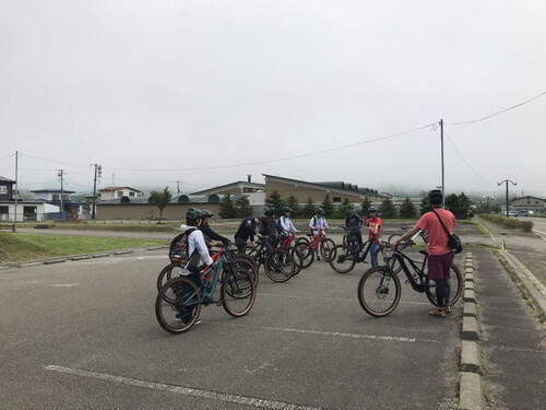
Up the hill we went, and stopped in front of the ballpark.
We learned about the relationship between parasites that live in a common amber snail and birds.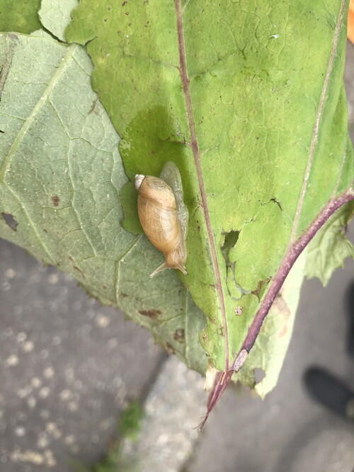
We also talked about the Ainu legends surrounding Mt. Kannon.
Just a week or so ago, there were some Siberian lilies here. This flower is often found along the roadside in Hidaka and along the coastline. 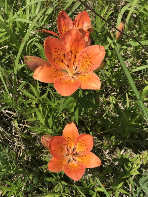
We touched on the history of the Hidaka Mountains and the ballpark.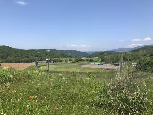
The Oyako-iwa Fureai Beach was covered in mist.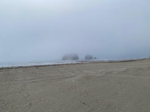
While at Sobira-iwa, the participants were excited to hear about the birds and see photos taken before the landfill in 1934.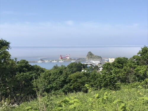
Here was an early morning view of Cape Enrumu, where magma cooled and solidified to create the geological folds. It's surrounded by Hidaka kelp and a thin layer of fog. 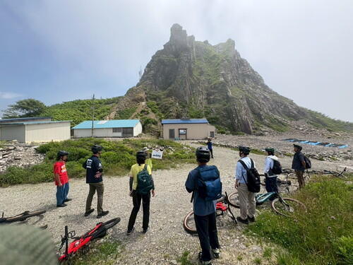
This was our first E-MTB tour, and we managed to end it without incident.
I think next time it would be interesting to take the bikes out on a dirt trail or out towards Saman Dam.
Even the parking lot at the Visitor Center was full of hikers! Overall, it was a pretty great day!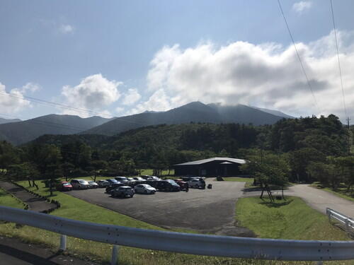
2025.06.18
Early Summer in Samani
In early June, I went to check out the route for the E-MTB tour. Here's a little report on the summer flowers and scenery.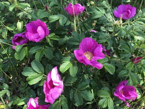
This is the Hokkaido hamanasu (beach rose). Jam made from the hamanasu rose hips is delicious!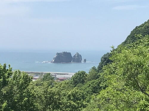
Oyako-iwa from the Sakae-machi road. 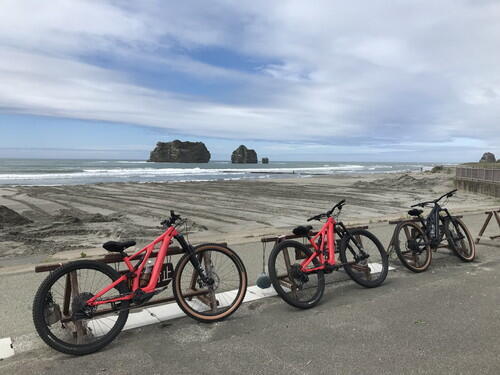
Oyako-iwa Fureai Beach
The beach is preparing to open up for the summer. 
I ran into a fox in front of the Mt. Apoi Geopark Visitor Center.