

Blog
2023.10.23
Visit from the Hong Kong Lions Nature Education Foundation
On October 4-7, six members of the Hong Kong Lions Nature Education Foundation (LNEF) visited Samani Town and toured around the Mt. Apoi Geopark. LNEF has many ties with UNESCO Global Geoparks, and through a recent connection with the Hong Kong UNESCO Global Geopark, we were able to arrange a visit to Mt. Apoi Geopark.
The tour officially started on October 5th, at the same time that the region experienced a severe weather event. Around 222 ml of rain fell during a 24-hour period causing major flooding and landslides in the West Samani district, closing the national road that leads out of Samani.
We were able to continue the tour even with the severe weather, but we did have to adjust the schedule. We started off at the Visitor Center so the LNEF members could learn more about the Geopark. From there we headed to Cape Enrumu where we had a brief break in the rain. 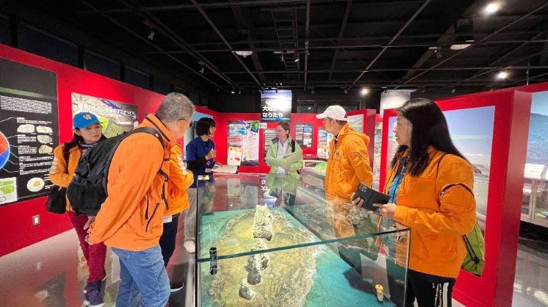
Mt. Apoi Geopark Visitor Center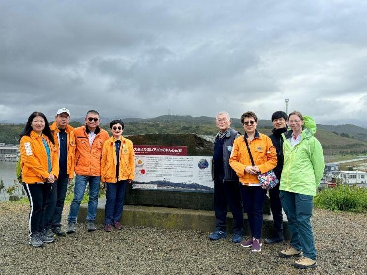
Cape Enrumu
Next, we alighted at the Central Community Center where we at the Apoi Dream Bento, designed by Junior High students, for lunch. It started raining again after lunch so our next stop was the Samani Public Library to watch the Samani Folktales videos and explore the Geopark Corner.
There was another break in the rain so we were able to drive to Horoman-kyo Gorge to see the Toho Olivine quarry and enjoy a tea break at the Horoman Community Center. On the way back to the hotel we paused at the former plate boundary site, but it began to rain heavily again so we did not stay long. Dinner was at a local restaurant, Ominaeshi, which served a delicious sashimi and tempura dinner.
The schedule for the second day of the tour was also adjusted and focused on more indoor activities like stone polishing and the Ainu embroidery class where the LNEF members enjoyed trying on traditional Ainu clothing and had an introduction to the history of the Ainu people. Luckily the rain stopped for a while in the afternoon, just long enough for a Bura Apoi Nature Walk. 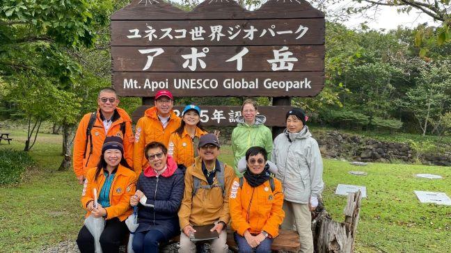
Bura Apoi Nature Walk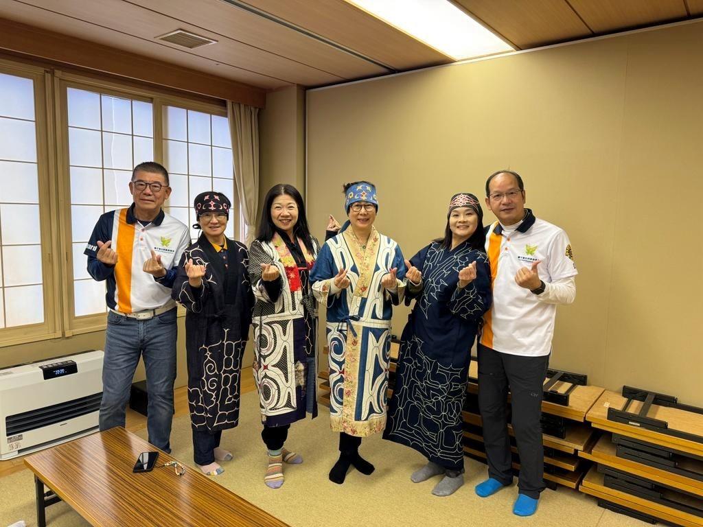
Traditional Ainu clothing
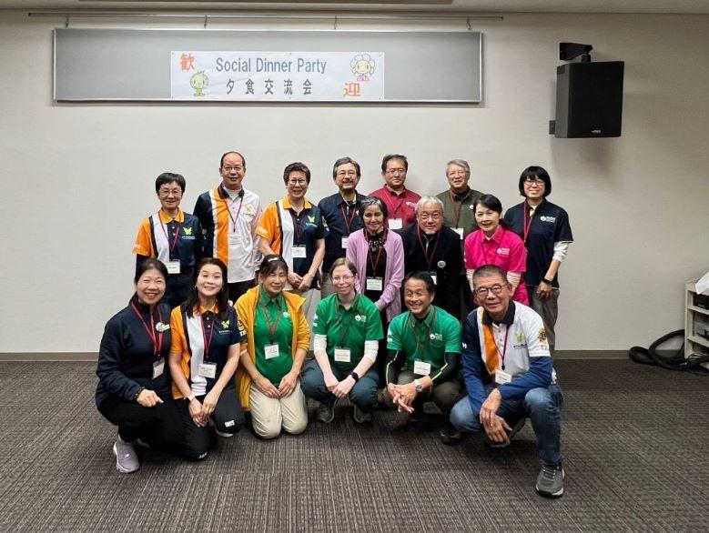
We also had a chance to drive further into Horoman-kyo Gorge and saw some salmon swimming upriver and laying eggs. At the very end of the day, there was a social dinner party held at Hotel Apoi Sanso. During the dinner, the LNEF representative gave an enlightening presentation on the Hong Kong Lions Foundation activities and collaborative work with the Hong Kong UNESCO Global Geopark. LNEF also presented Mt. Apoi Geopark with a commemorative plaque and publications celebrating the LNEF 30th anniversary. It was a great way to end the two-day tour. 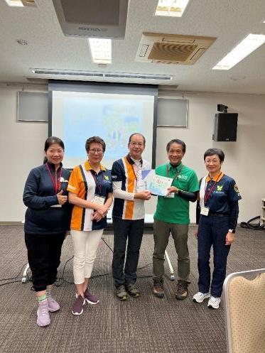
2023.08.21
Apoi Starry Sky Observation Event
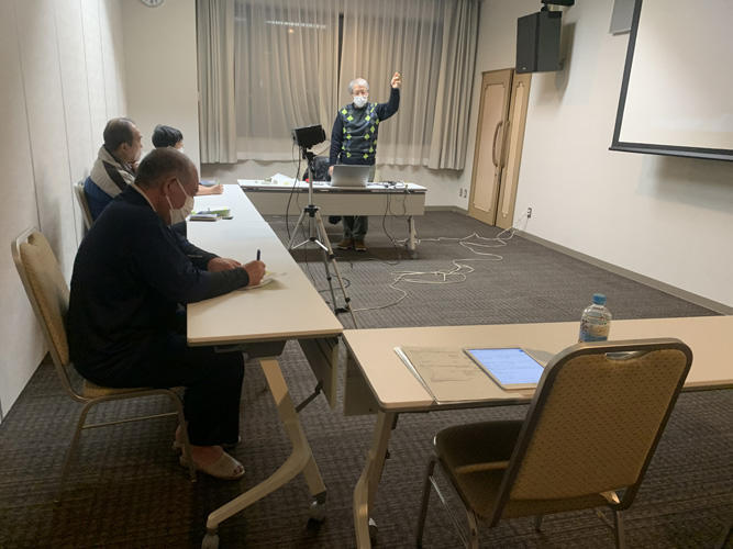
The Apoi Starry Sky Observation events are hosted by Hotel Apoi Sanso about twice a month and are led by Mt. Apoi Geopark certified guides. Here is a look at the event held on Saturday, August 12th.
It was overcast on August 12th when 15 participants showed up for a Starry Sky Observation event. We all sat together in a meeting room at Hotel Apoi Sanso while our guides, Mr. Shimada and Mr. Abe, gave a presentation about the night sky and what stars and constellations are visible this time of year. The explanations not only covered various constellations but also introduced the Ainu constellation names and meanings.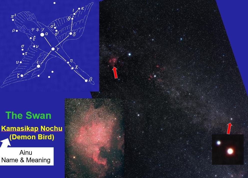 This event was perfectly timed during the Perseids meteor shower which is commonly seen in August.
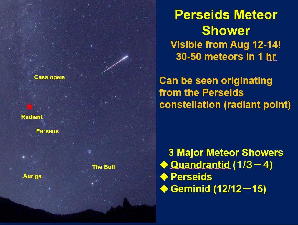
The last part of the indoor presentation taught us how Mt. Apoi is connected to space. Mt. Apoi is made of rare peridotite rock, and samples brought back from the Hayabusa space mission contained peridotite! The guides passed around a sample of peridotite and some meteorite pieces for everyone to look at. 
Mr. Shimada quickly ran outside to check the weather and happily announced that some of the clouds had parted and we could see the stars. The hotel lent small flashlights to all the participants and we headed out past the parking lot and climbed up a small hill behind the hotel to a dark and open area.
The clouds parted and the stars and Milky Way came into view. The guides used a laser pointer to point out some of the stars and constellations that were previously introduced. We saw the swan, the summer triangle, and more. We even saw several meteors from the Perseids meteor shower streak across the sky.
Please check Hotel Apoi Sanso's website for future information about the Apoi Starry Sky Observation events.
https://www.apoi-sanso.co.jp/
We look forward to seeing you!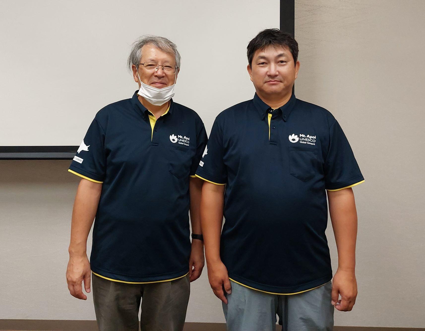
2023.08.14
UNESCO Global Geopark Revalidation Mission: Part 2
July 6: Day 3
We began day three at the Samani Public Library, where the librarian showed off a collection of Geopark-related materials called the Geopark Corner. They also discussed the cooperative projects held between the Samani Folk Museum, Mt. Apoi Geopark Visitor Center, and Samani Public Library called the "Kan x Kan" event series. We also watched two of the new animations produced by the library to tell the story of the Ainu legends related to Samani. 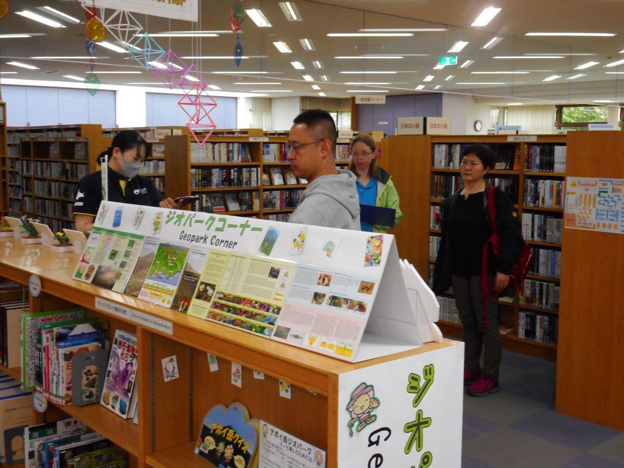
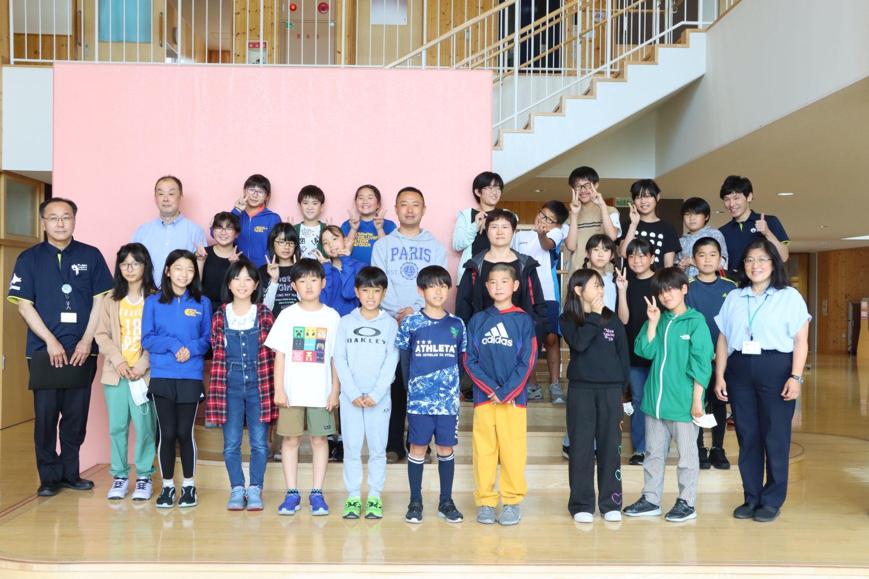
After this, we stopped at the old quarry behind the elementary school and the Peridotite Plaza before heading to Samani Elementary School. At the elementary school, as part of Sapporo Otani University's "Otani Art Caravan," the fifth graders were learning how to make Japanese-style paints by crushing peridotite rock. The evaluators were very interested in the process while observing the class. Afterward, everyone took a group photo.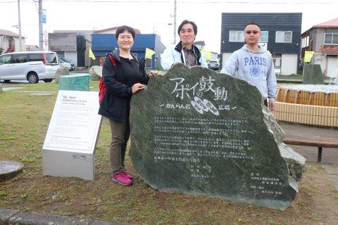
Lunch was held at the Horoman Community Center, located at the entrance of Horoman-kyo Gorge. Here we were greeted by the residents of the Horoman area, who prepared miso soup with kelp and funori seaweed from the Horoman coastline. We enjoyed the delicious meal together with the Apoi Dream Bento, a lunch set designed by the students of Samani Junior High School to represent Mt. Apoi Geopark.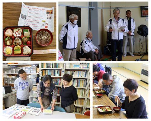
After lunch, the Geopark Academic Advisor Dr. Niida, gave a tour of the Geo-Labo. We then stopped by the Inari Shrine site in Horoman-kyo Gorge where we heard about the diverse types of peridotite and the hydroelectric power plant. We enjoyed eating peridotite mochi (rice cakes) and kombucha (kelp tea) made by the Mamma no Kai while relaxing next to the river.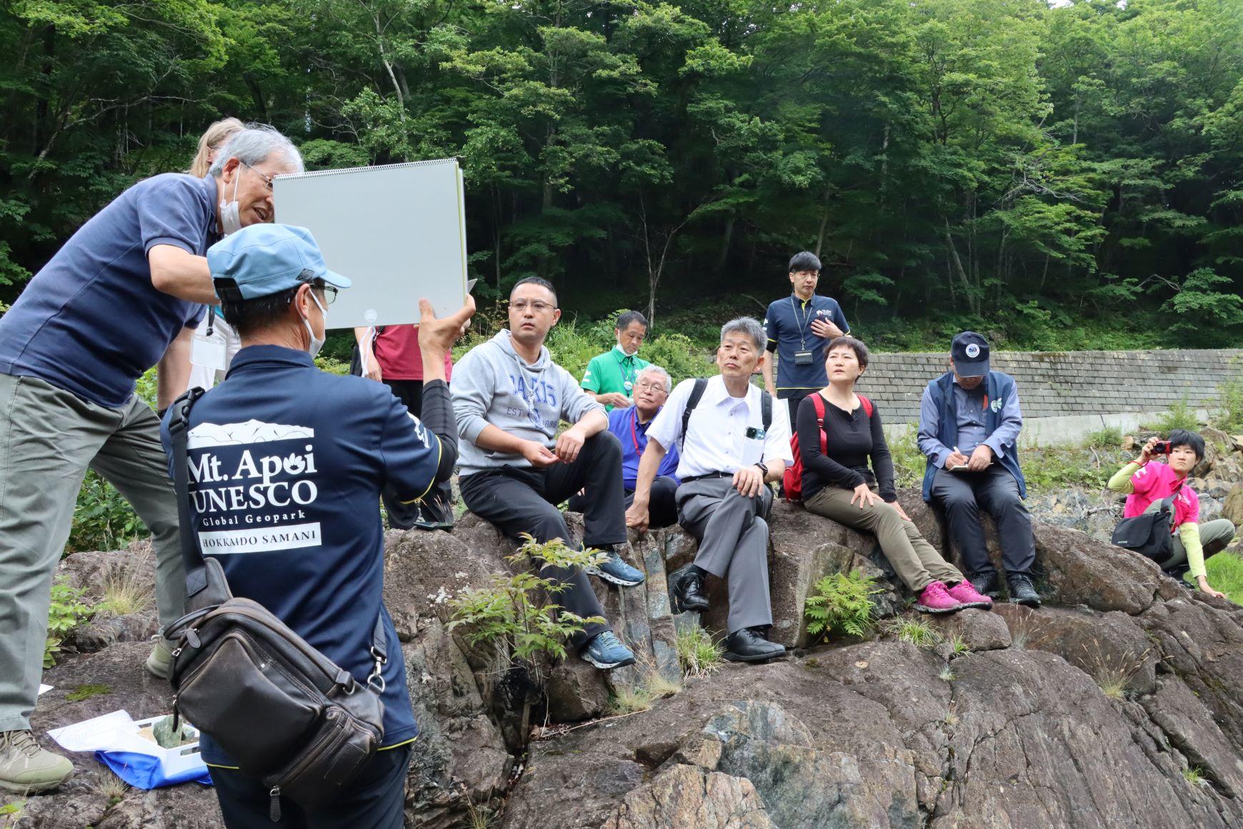
July 7: Day 4
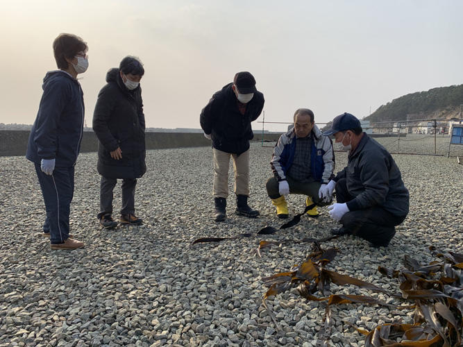
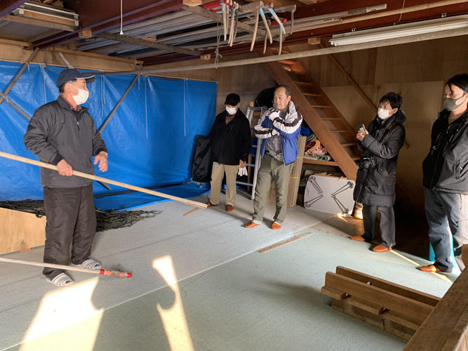
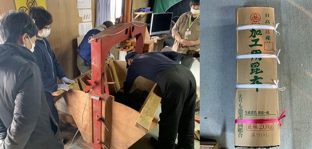
On the fourth day, the evaluators visited Mr. Tsukada's kelp workshop in Fuyushima early in the morning. Here, the evaluators were given a glimpse of what kelp harvesting is like. Everyone took turns laying out the kelp to dry, then we went inside the workshop to see how the kelp is cut, separated, sorted, and boxed. Mr. Jing experienced the process of cutting and sorting bundles of kelp and was very efficient at it.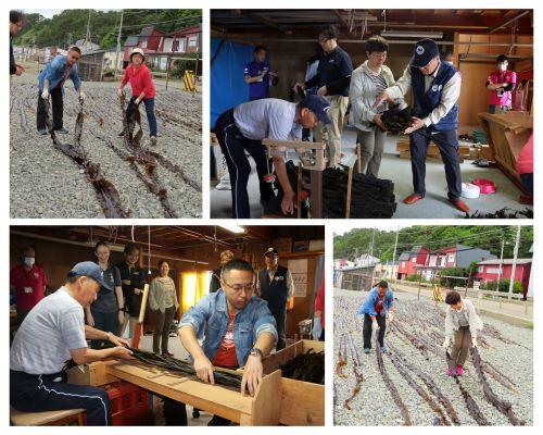
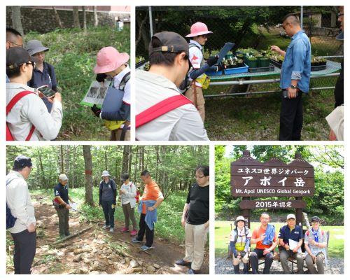
Next, we headed to the foot of Mt. Apoi for a "Bura Apoi" nature walk and a guided climb up Mt. Apoi to the second rest area. Although the temperature was high that day, the evaluators had many questions about how the trail was maintained and what animals could be seen.
Today's lunch was prepared and provided by a local organization called Manma-no-Kai and consisted of many regional dishes. The boxed lunch and miso soup made use of locally caught seafood and was very delicious. Everyone enjoyed the lunch and many had second helpings. The rest of the afternoon was spent visiting the Samani Tourism Information Center and other Geopark sites such as the backside of Cape Enrumu, and Ana-iwa (Hole rock) in Fuyushima. 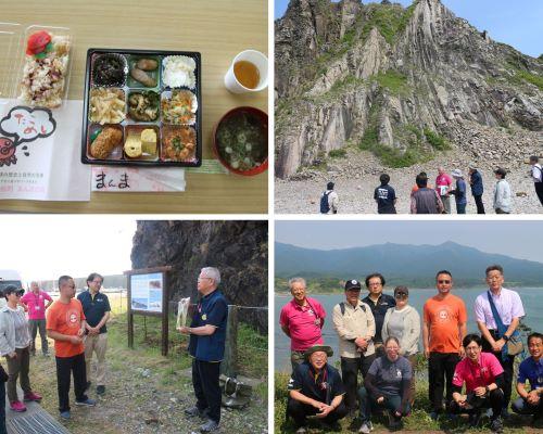
July 8: Day 5
This was the final day of the revalidation. The closing meeting was held first thing in the morning where the evaluators gave their overall impressions of the Geopark and some advice for the future. As town representatives and residents gathered to see the evaluators off, we left the venue and stopped at the Oyako-iwa Fureai Beach to explain a tsunami evacuation drill happening that day and left Mt. Apoi Geopark.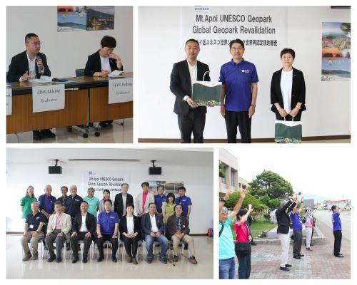
We feel that the mission was a great success, but we could not have done it without the support and assistance from the townspeople, local organizations, guides, elementary and junior high teachers, and students. We are so grateful, from the bottom of our hearts, for everyone who supports the Mt. Apoi Geopark.
We want to express our deepest thanks to the two Geopark evaluators and the Japanese Geopark Committee advisor for their role in the Mt. Apoi Geopark revalidation mission.
The results of the revalidation mission will be announced early next year!
2023.08.14
UNESCO Global Geopark Revalidation Mission: Part 1
On July 4-8, the Mt. Apoi Geopark underwent a UNESCO revalidation mission. UNESCO Global Geoparks are subject to an evaluation every four years to ensure the quality and functionality of the Geopark.
July 4: Day 1
On the first day of the revalidation, the two evaluators, Mr. Jing Zhixing and Dr. Han Jingfan, and Professor Nakada of the Japan Geopark Committee arrived in Samani Town.
The Opening Meeting was held upon arrival their arrival. Here the evaluators were welcomed by officers of the Mt. Apoi Geopark Promotion Council and local residents.
After the Opening Meeting, a welcome dinner was held at Hotel Apoi Sanso during which presentations on joint activities between Hotel Apoi Sanso and the Geopark, such as the stargazing lectures and the Hokkaido Mokka Butter Sandwiches. 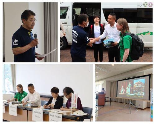
July 5: Day 2
From the second day, the evaluators were taken around the Geopark, tour-style, to introduce the activities of the Mt. Apoi Geopark. The evaluators started the day at the Samani Junior High School where they heard a presentation about the "Hometown Apoi Studies" educational program. Next, they observed a class where the students were preparing for an overnight research trip to Shikaoi Geopark in Hokkaido. 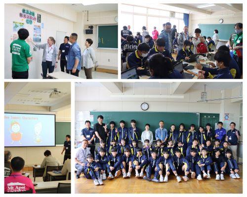
The rest of the morning we included visits to Cape Enrumu, the Samani Folk Museum, and the Okada Cise. At Okada Cisse, after a welcome speech by Mr. Kikuchi, Vice President of the Ainu Association of Samani, we toured the interior of the cise and learned about the culture and history of the Ainu people. The lunch consisted of delicious dishes such as inakibi rice, grilled fish, a dish of mixed kabocha pumpkin, corn, Amur cork tree berries called Rataskep, a cold soup made from dried cod, seaweed, and long onion called Yamaw.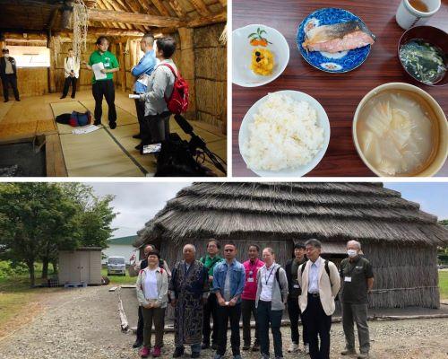
After a delicious lunch, we went to Tojuin Temple. Here we learned about the cultural and historical importance of this temple, one of the three official temples of Ezo, which was built here partly because of its geographical location. We also enjoyed a traditional Japanese tea ceremony in the main hall.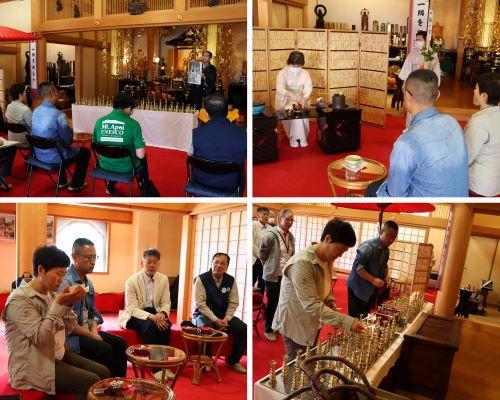
Next, we headed to the Yamanaka Ooma, the newly established Geopark site that highlights the former plate boundary that created the Hidaka mountains and Mt. Apoi. The evaluators heard from the three individuals who helped conduct a scientific survey of the area. The evaluators were very impressed by the importance of this site. After everyone completed a "plate jump" across the plate boundary, we headed to the Mt. Apoi Geopark Visitor Center to review the origins, nature, culture, and other exhibits of Mt. Apoi Geopark.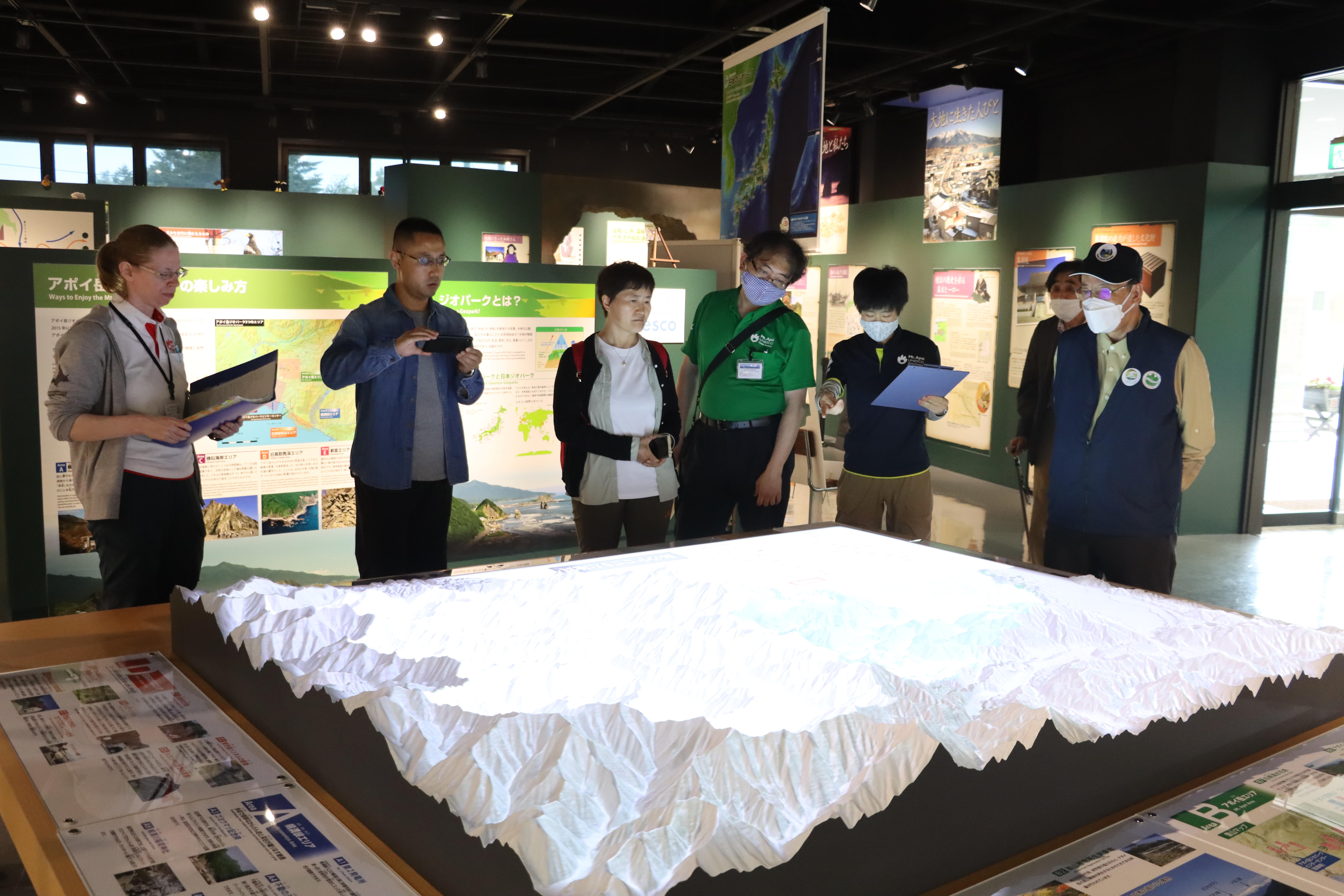
At the end of the day, an exchange dinner was held with the evaluators, the Mt. Apoi Geopark Guide Association, and the Samani Indigenous Culture Preservation Society. During the dinner, an ancient Ainu dance performance, which was designated as a UNESCO Intangible Cultural Heritage in 2009, was performed, and many attendees participated in and enjoyed the final ring dance. A picture-story show, "The Story of a Grain of Sand," was also presented on the origins of the topography of Samani, and a skit by the Mt. Apoi Geopark Guide Association and the Mt. Apoi Fan Club showed the nature conservation activities of Mt. Apoi in a comedic manner.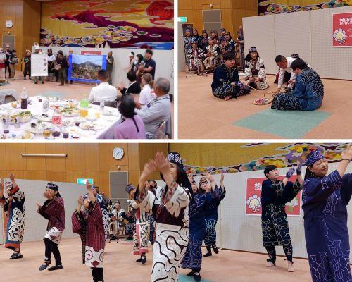
2023.03.09
Held the Winter Geo-tour for the first time in 3 years!
Wednesday, March 16
Day 1. We kicked off the winter tour with a close-up look at Fuyushima kelp harvesting.
Local fishermen explained how they harvest kelp and the tools they use, for example, a hook and twister rod.
Kelp leaves go through a selection process and are cut to size.
The participants were pleased to learn about the kelp harvesting process and surprised to learn that the grade of kelp is determined by the color of the rope that is used to type up the kelp before shipping.
Next was a meal at Hotel Apoi Sanso made from local ingredients, and afterward, everyone participated in a star-gazing event led by the geopark guides.
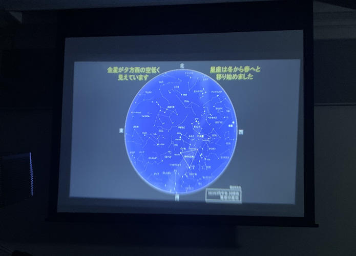
The geopark guide used a projector to explain the different constellations and where you can find them during winter. Unfortunately, the weather did not cooperate and we were unable to view the stars outside. Many of the participants said that they would like to come back on a clear night and search for the constellations.
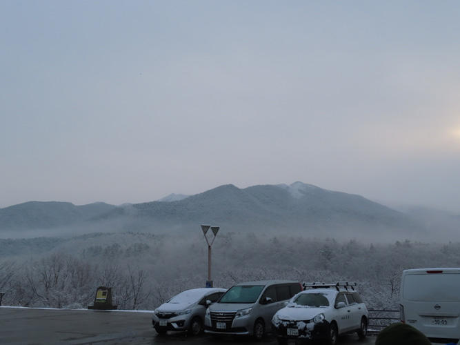
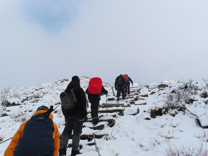
Thursday, March 2. Today's main event was a winter trek up Mt. Apoi. Snow fell on Mt. Apoi overnight and was covered in a shining white blanket. Here we began the winter climb up Mt. Apoi.
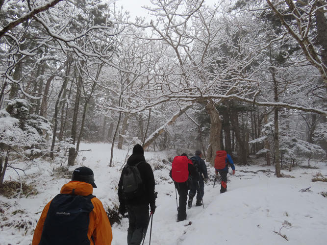
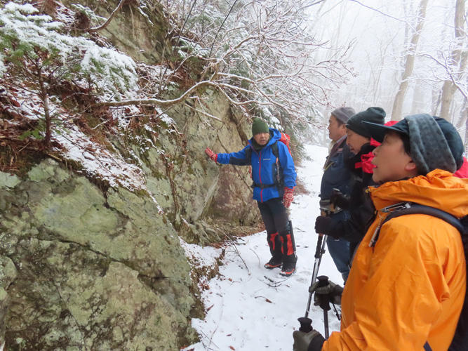
The hiking guide stopped every so often to talk about the formation of Mt. Apoi and the various plant life.
The snow became deeper as we passed the 5th station. Our surroundings were completely white as we walked through the clouds. Due to the clouds, there wasn't any scenery to enjoy so we kept pushing forward.
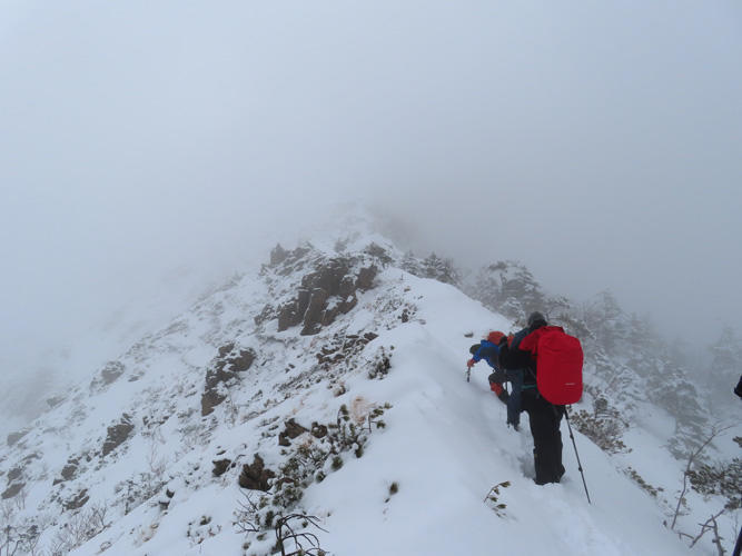
The snow became deeper along the ridge and it was softer due to the warmer temperatures, burying our feet and sapping our strength as we continued.
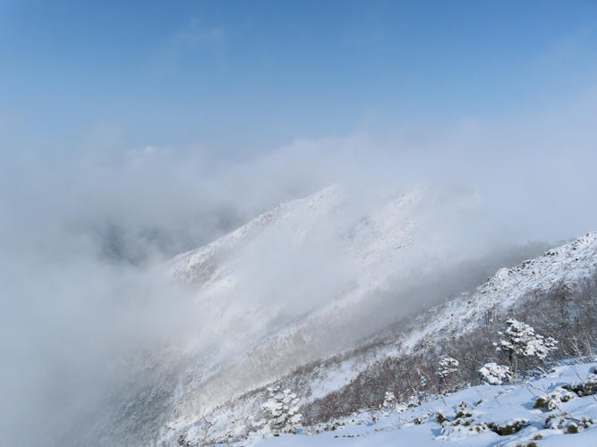
Just as we were about to give up, the wind picked up and began to push the clouds away.
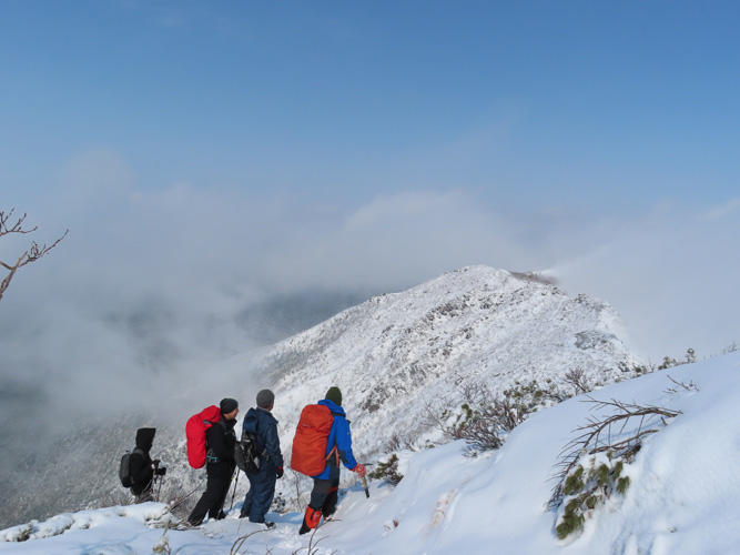
The ridgeline of the Apoi mountain mass finally appeared. Seeing the peak of Mt. Yoshida floating among the clouds made us feel like we were in a mountain range over 3,000 meters high.
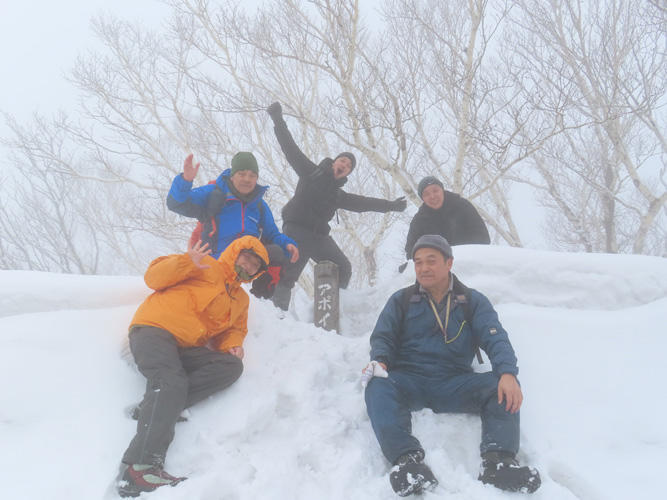
The weather cleared for just that brief moment but it was a wondrous sight. The tour participants took a commemorative photo at the top of Mt. Apoi.
The tour was a great opportunity for others to experience the beauty of Mt. Apoi and the Mt. Apoi Geopark during winter.