
Blog
2020.08.31
Horoman Gorge Monitoring Tour
We recently held the second guided monitoring tour for foreign visitors. The purpose of these tours is for our geopark guides to become more familiar with handling foreign visitors, test out potential activities that would appeal to foreign visitors, and to foster teamwork between the guides and the geopark interpreter.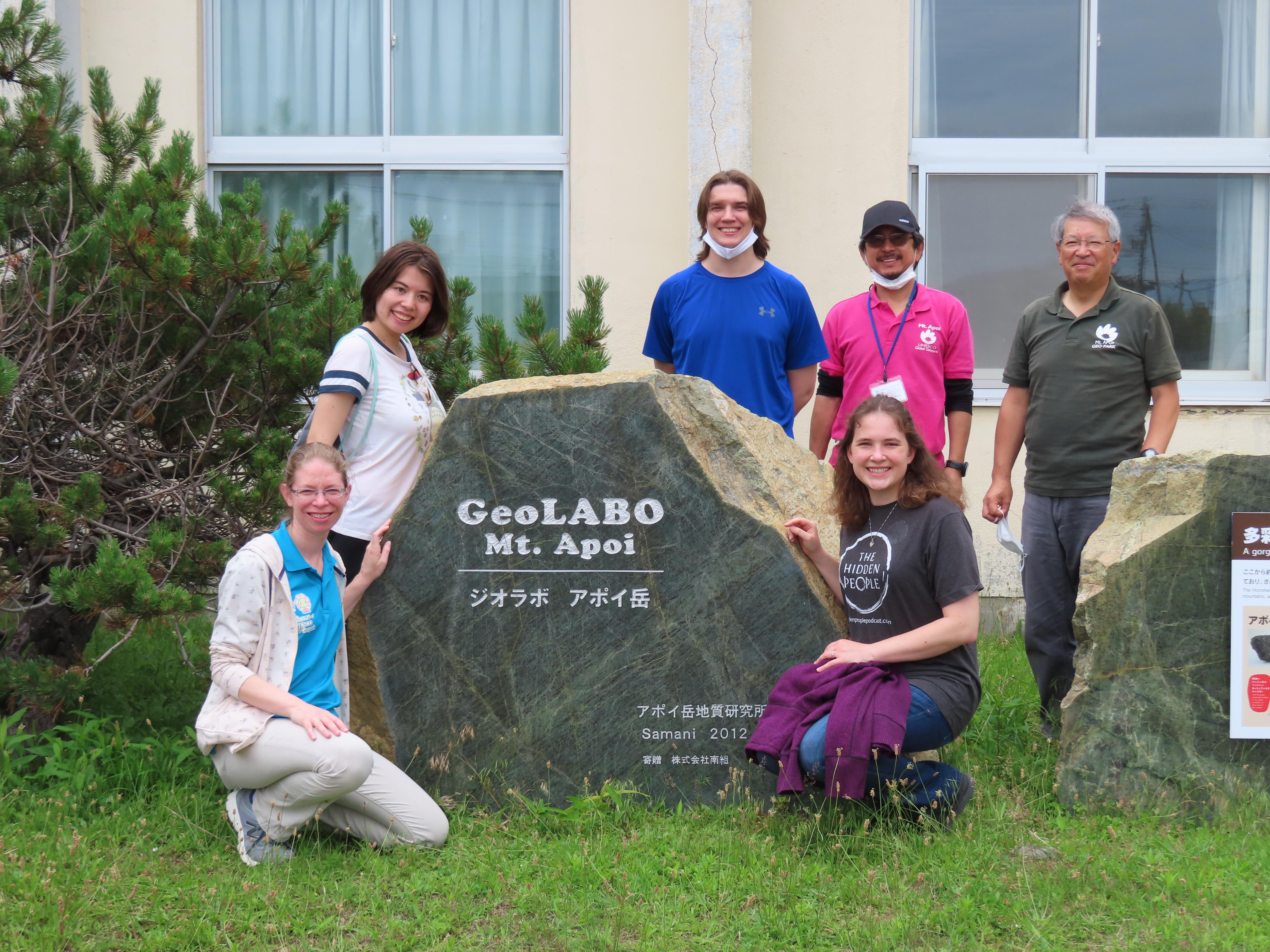 This time we decided to explored the Horoman Gorge. We met with the participants in front of GeoLabo Mt. Apoi. This tour was also kept to a small group of 3 ALTs, 2 guides, 1 interpreter, and 1 geopark staff. Luckily, we had decent weather this time around even though there was a small threat of rain that day. We introduced the guides for the day and then loaded up into a 12-passenger van to start our journey up the gorge.
Along the way to our first stop we saw the Toho Olivine Industrial Co. Ltd. that has an active quarry in the gorge. The rock and gravel that is mined here can be found all throughout Samani.
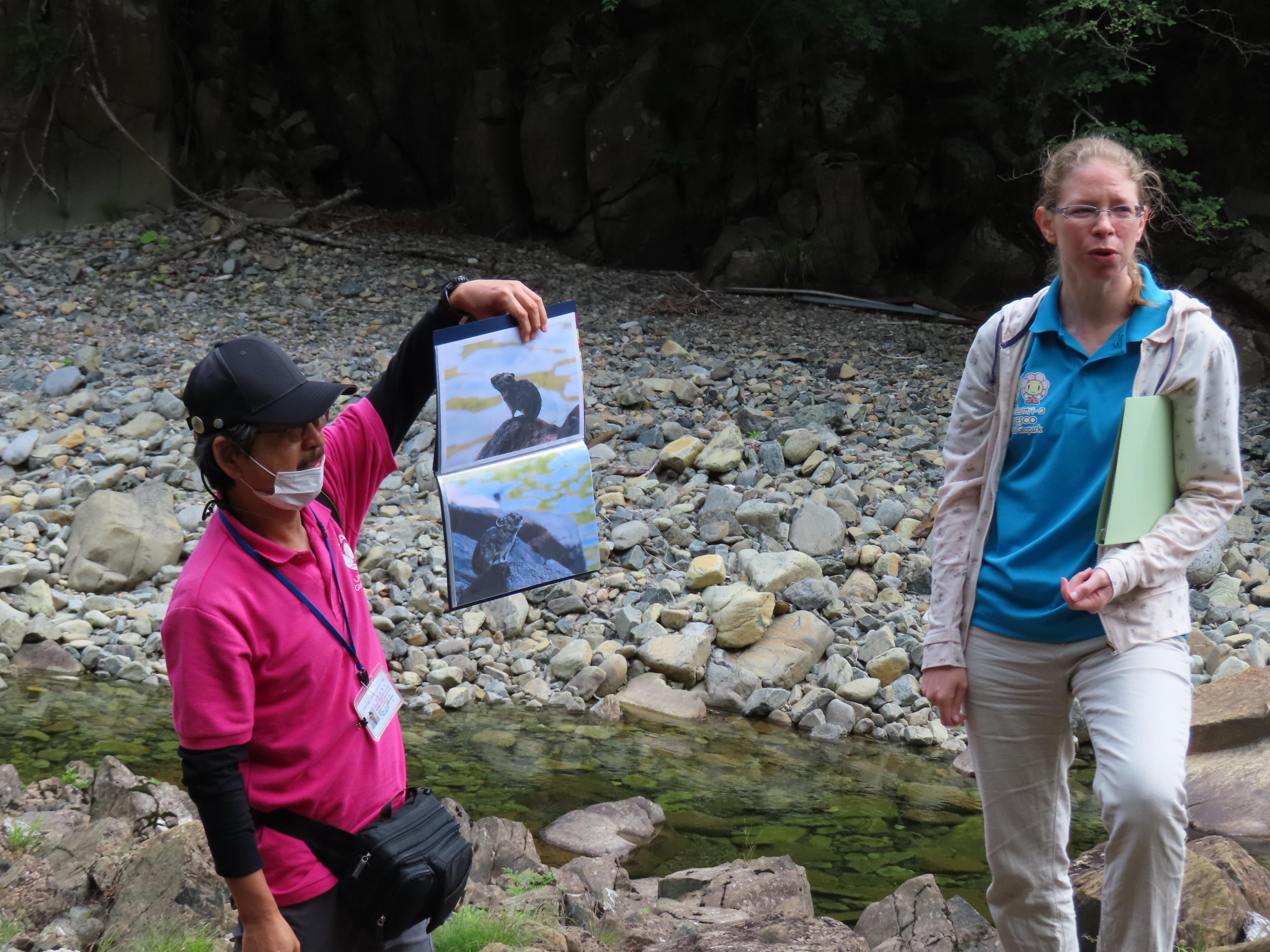
Our first stop was at Geosite A3, the Japanese White Pine Monument. The Japanese White Pine (or Goyomatsu in Japanese) are found throughout mainland Japan, but here they are at the northernmost boarder of their natural habitat. Because of this this pine forest has been recognized as a National Natural Monument by the Japanese government.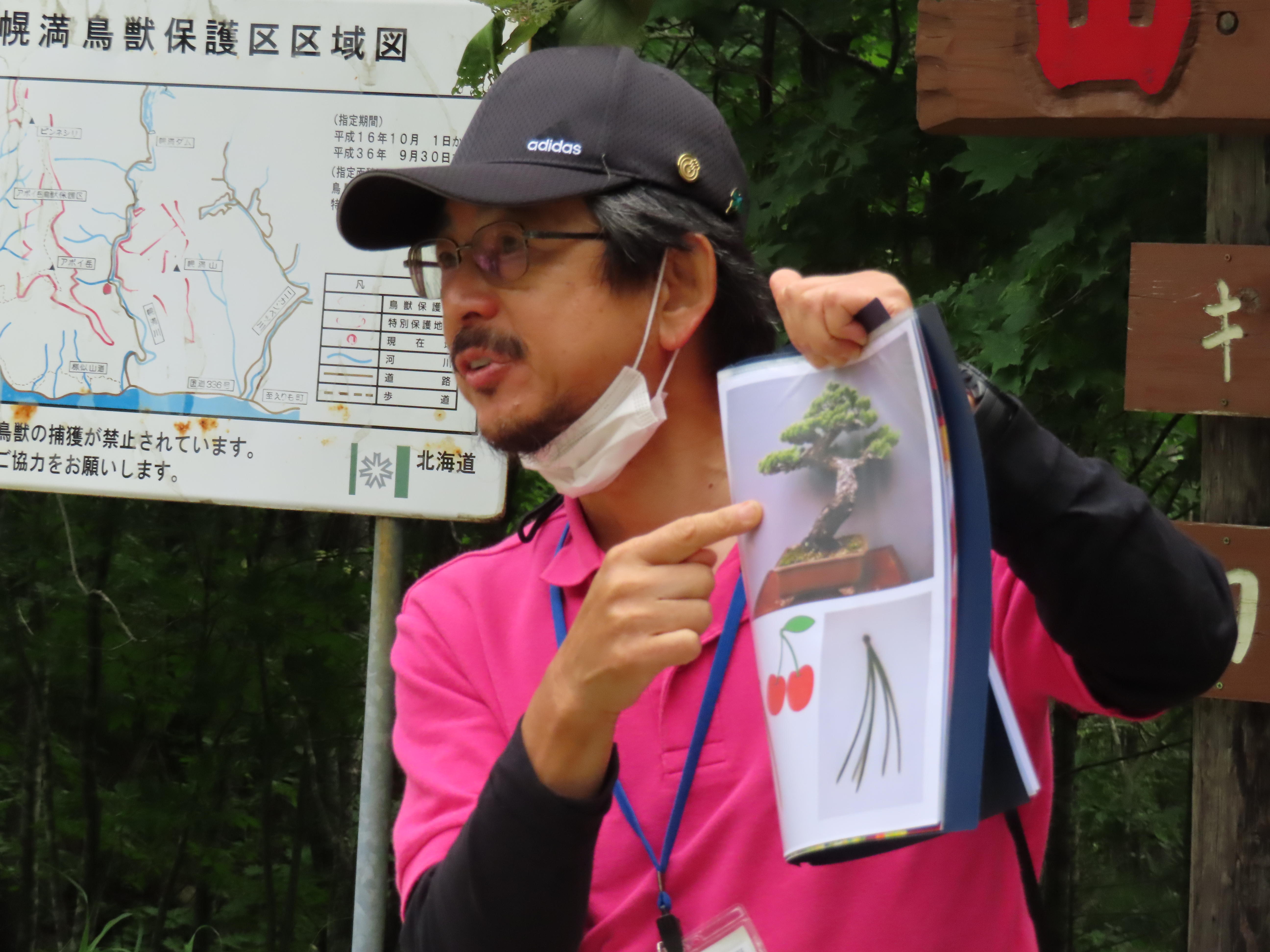 These pines are also different from other pine species since they have five needles per sheath verses other pines which typically have only two needles. The area around Geosite A3 is also home to the Japanese Pika. Pikas are typically found at high elevations of 150+ meters, however, this is the only place in the world where the pika can be seen at a mere 50-meter elevation. They are cautious creatures by nature, so unfortunately, we were unable to see one in person. Then we walked down to the river to learn about the Horoman Peridotite, its origins, and how peridotite is thought to be the mother of all rocks.
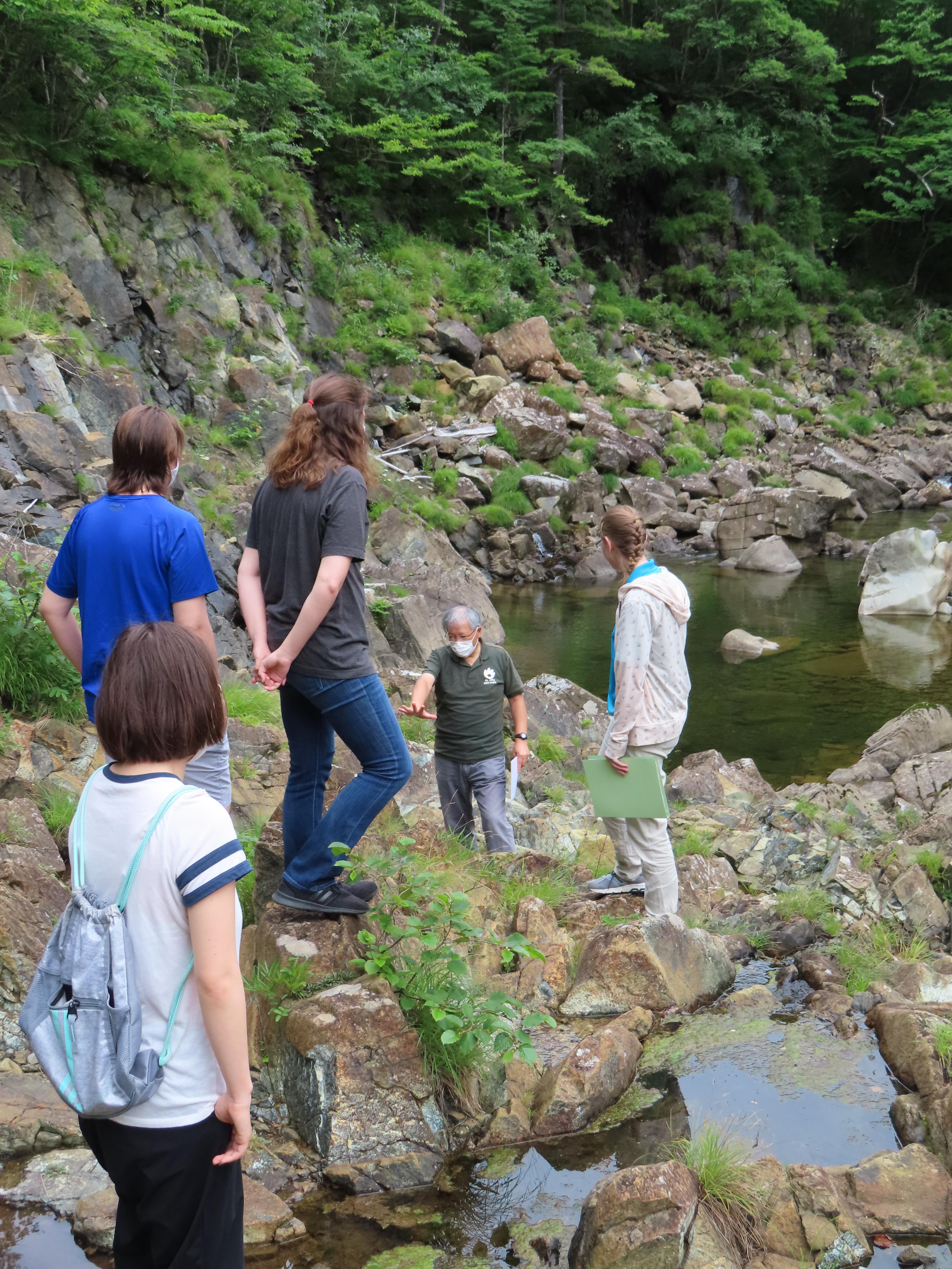
 Next, we stopped at the Horoman River Inari Shrine, Geosite A6. Here our guides explained a little bit about the history of Inari Shrines and why they are connected to foxes. In the past Japanese practiced Animism, which is the idea that gods reside in plants, animals, and inanimate objects. During the rise of rice farming in Japan, foxes became highly valued since they kept away rodents that would eat the rice. Hence foxes became guardians of the gods and received a special spiritual status. It is said that the fox's favorite food is fried tofu called inari, which is why sushi rice served in tofu bags is called inari sushi in Japanese. One of the guides had prepared some inari sushi to share with the participants.
 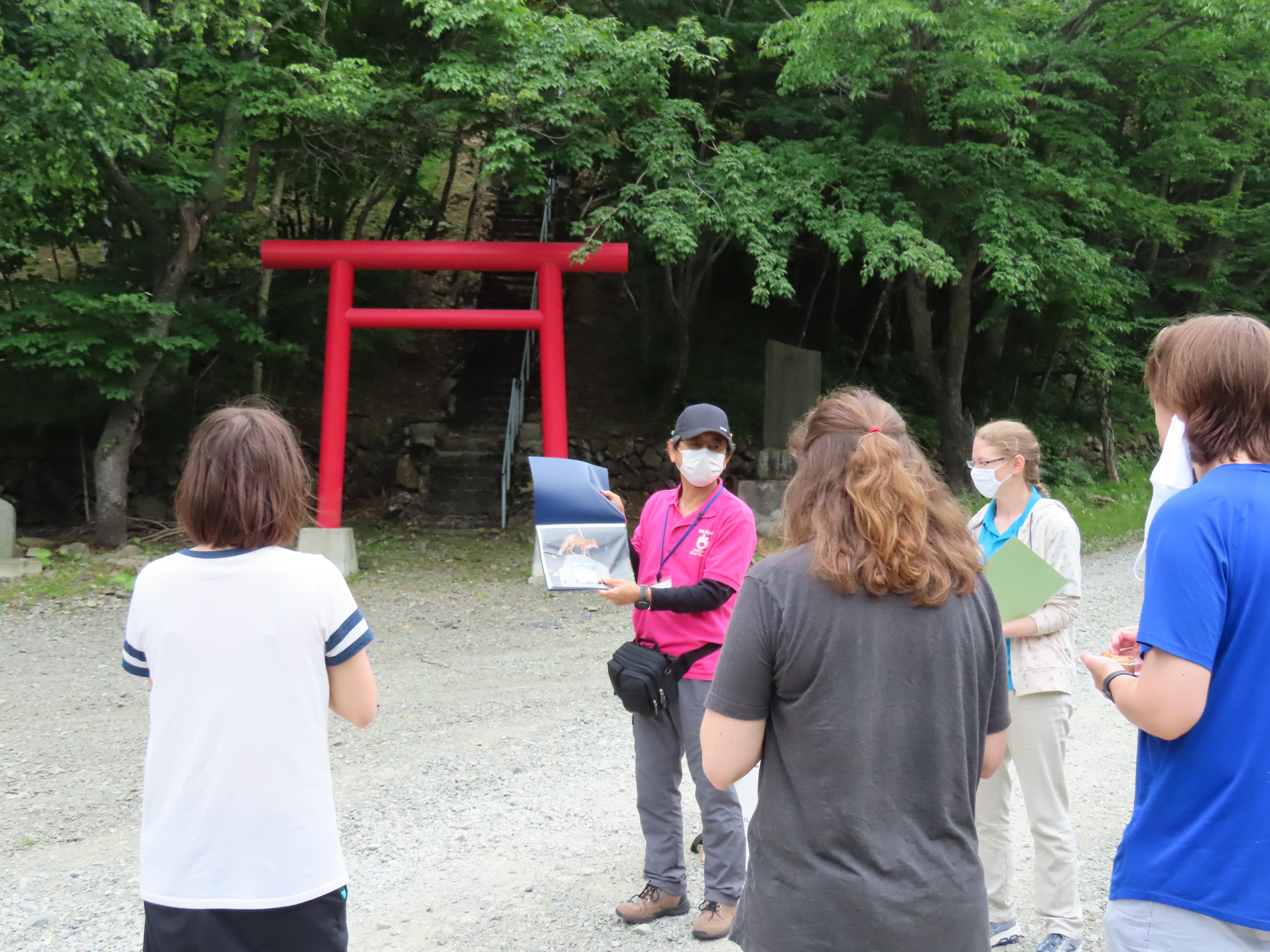 The Horoman River Inari Shrine was constructed in 1936 by Hidaka Electric, a hydroelectric power facility in the gorge that uses the river water to generate electricity for towns along the Hidaka coastline.
 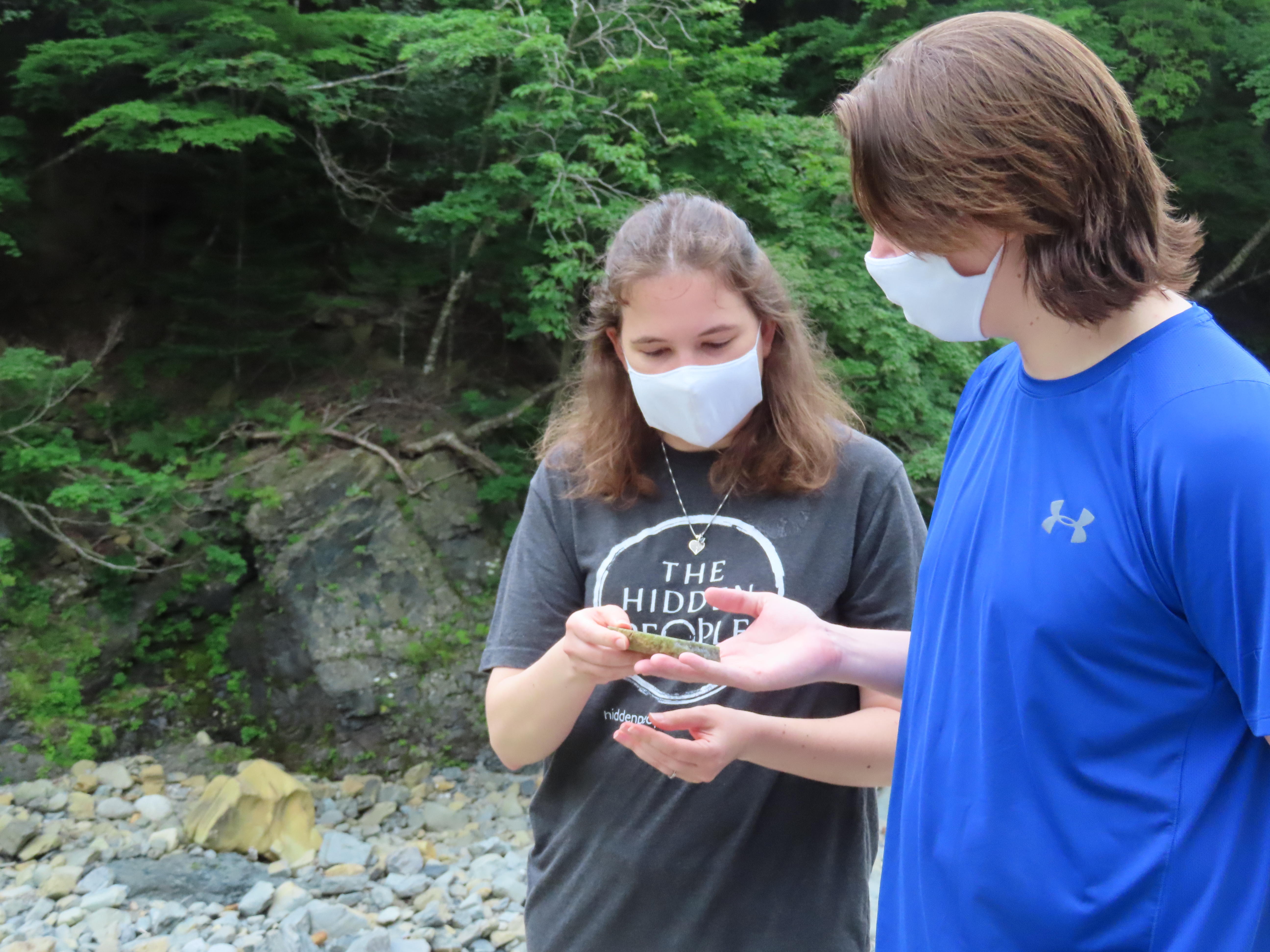 After Inari Shrine we hopped back in the van to visit Geosite A7, the Horoman Dam (Power Station No. 3). The Horoman Dam sits at the border of the Horoman Peridotite Complex, which is easy to understand as the landscape changes dramatically. On a clear day you can see the Hidaka Mountains. Unfortunately for us it was a bit overcast with clouds blocking the view, so we looked at a photo instead. Here the composition of the ground changes from the hard peridotite rock to softer gabbro and other metamorphic rocks.
 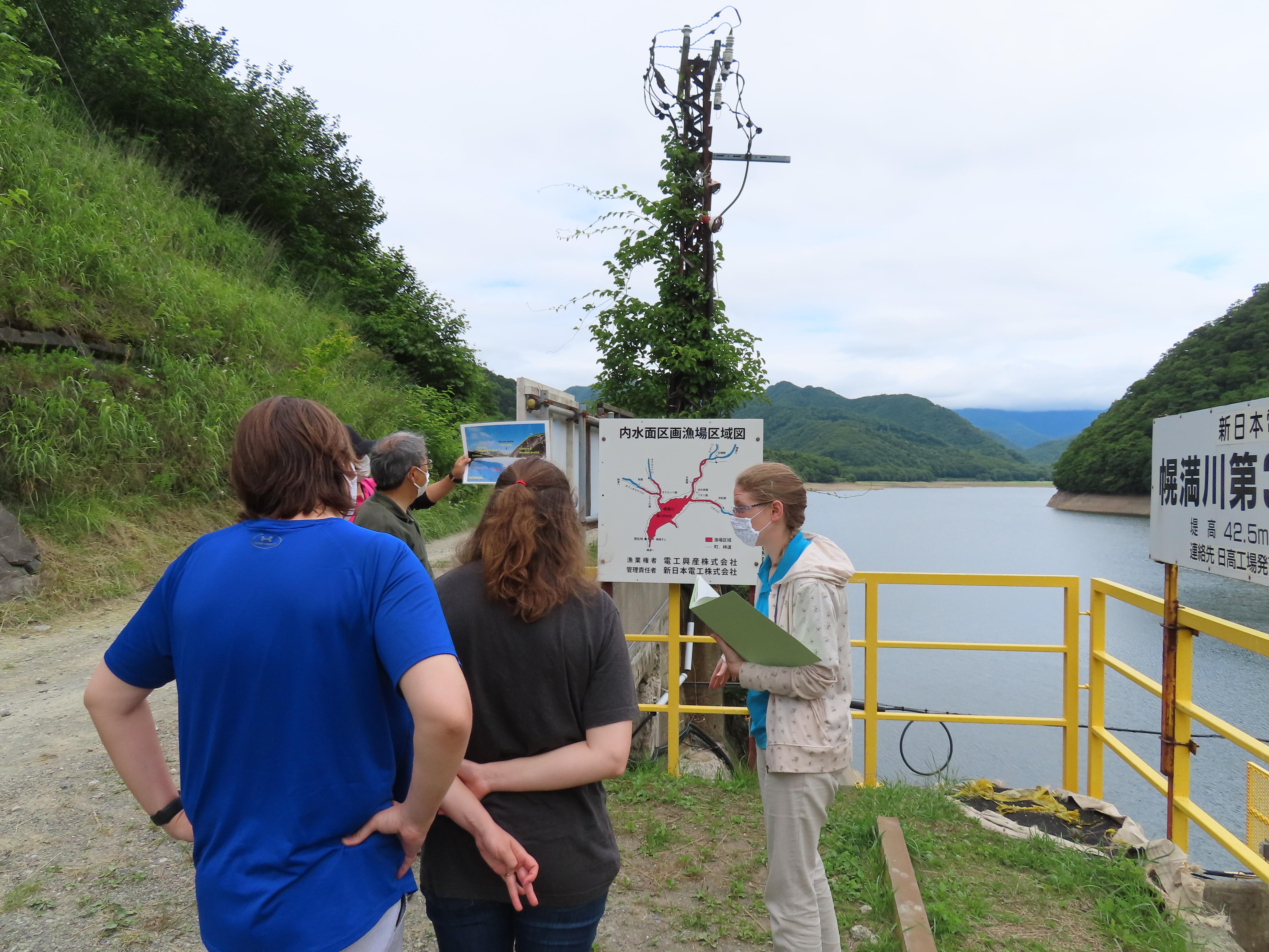 Our guide used a diagram of the rock stratus to explain that when the North American and Eurasian continental plates collided here to create the mountain range, the North American plate was pushed up which created a unique vertical stratification. Standing at the dam is like standing atop the upper mantle of the earth, and gazing out across the lake you can visualize how the different rock layers of the continental plate shaped the land millions of years ago.
It was easy to understand the guide's explanations since they also used photos and diagrams with English text.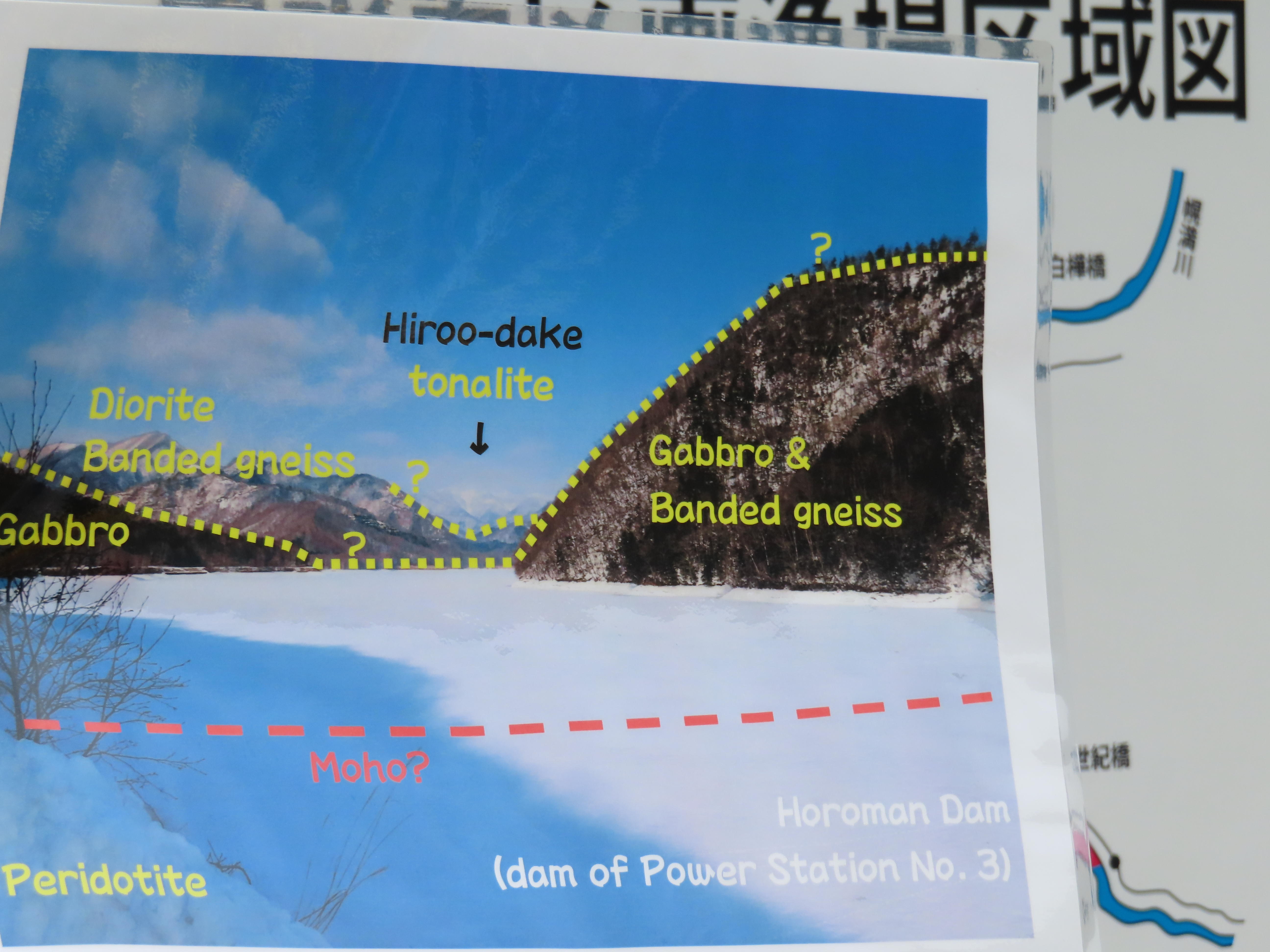
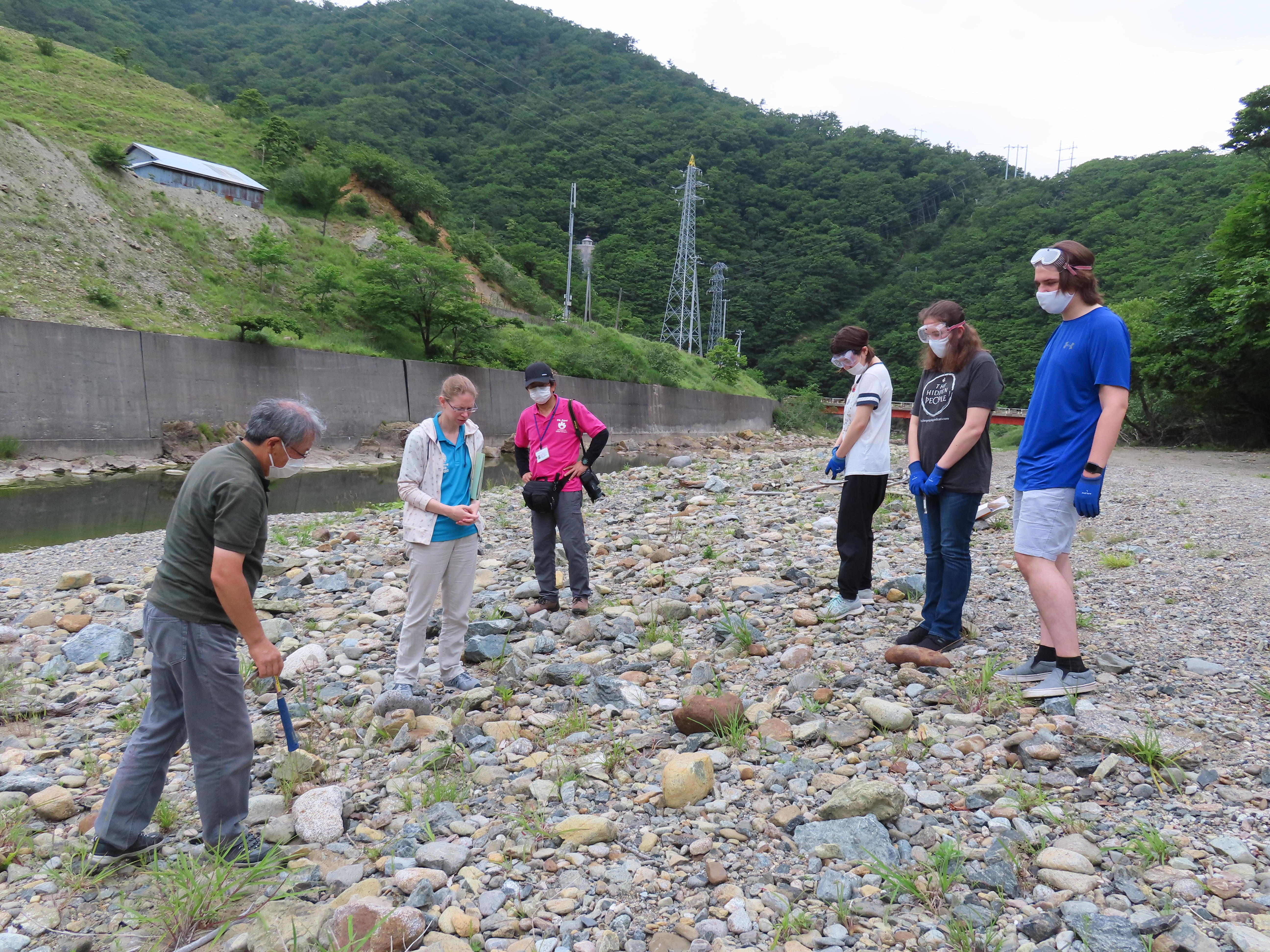
On our way back to the GeoLabo, we stopped at Geosite A2, the river bed near the quarry. Here the participants were given goggles, gloves, and hammers to try and crack open some of the river rocks to see what they could find. The weathered outside of the rocks is deceptive and the only way to see the beautiful mineral compositions is to break it open to see the inside. The participants had a lot of fun selecting just the right rock. In the end they found some beautiful specimens!