

Blog
2026.03.08
KanxKan Lecture Series: Coaster Making
On March 7 (Sat), we held the next KanxKan Lecture Series event: Coaster Making & Mineral Specimens.
First, staff from the visitor center explained how electricity from the Horoman hydroelectric power plants is used to melt manganese ore and other materials in electric furnaces at the Odori factory to produce ferroalloys.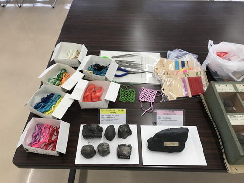
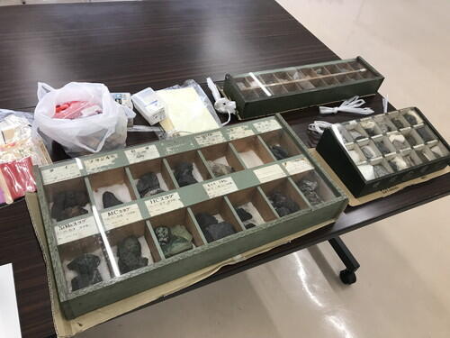
Staff from the Samani Folk Museum showed photographs of the manganese mine in Shintomi, Samani, and talked about the history of Toho Denka as documented in the 100th-anniversary commemorative publication of Shin Nippon Denko Co., Ltd.
Staff from the Samani Public Library introduced various books that guide readers through fun knitting projects to create beautiful projects. They also presented the Shin Nippon Denko Co., Ltd. 100th-anniversary commemorative publication and Shinkichi Tezuka's book "Horomangawa River," and handed out a booklist.
Coaster-making was a bit challenging, but everyone managed to create their coaster by weaving the cords together.
2026.02.26
Samani Disaster Prevention Workshop #5
Samani Disaster Prevention Workshop #5: Evacuating via Vehicle During a Tsunami
This workshop was held on Wednesday, February 25, 2026, where 70 participants considered various strategies for evacuating by car during a tsunami warning.
Theme 1: Make a Map
Participants labeled the following on enlarged maps:
The ocean, mountains, and rivers. The location of the workshop and the location of their homes. Drew a line marking the boundary between areas that will experience stronger shaking (seismic intensity lower-6 and upper-6). Drew a line where the tsunami inundation zone ends to confirm where a tsunami would not reach.
Theme 2: Remember Past Experiences
On December 8th of last year, a tsunami warning was issued for Samani after a strong earthquake. To summarize how everyone evacuated to safety, we marked the epicenter of the earthquake, the evacuation sites people actually went to, and the route they took on the map.
Theme 3: Tsunami Evacuation by Car
We used string to measure the distance and range that people could evacuate on foot.
Next, each group shared their concerns about evacuating by car during summer and winter scenarios - specifically before evacuating, during the evacuation, and after arriving at the evacuation site. Each group also considered potential obstacles and safe evacuation methods. Finally, each group presented their findings and shared opinions with the entire workshop. 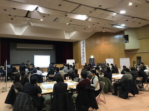
In my view, the two and a half months since the tsunami warning on December 8th have been a time for reflection. After hearing about difficulties with car evacuation and other options, it has helped me organize my thoughts and identify key considerations for evacuation.
2026.02.24
2/24 Apoi College & Apoi Nature Seminar
We recently held a Mt. Apoi College & Nature Seminar to help local residents learn mor about the nature surrounding them.
This time, our guest lecturer was Professor Takehiro Masuzawa of Shizuoka University, and he talked about "Japan National Park, Hidakasanmyaku Erimo Tokachi National Park ~The Current Roots of Alpine Plants and the Regeneration Efforts on Mt. Apoi ~." 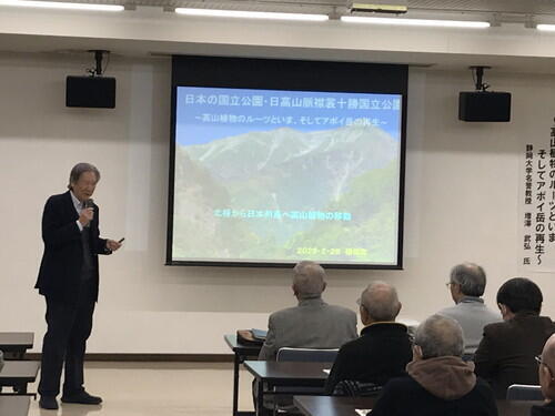
The lecture included information about what can be done for the declining alpine plants of Mt. Apoi, as well as the origins of these plants and the current severe situation, and restoration efforts. The Apoi-mantema blooms in early summer on Mt. Apoi, and is an alpine plant originating in the Arctic Circle, and it has evolved to adapt to the environment of Mt. Apoi. We also heard a story about how moving it was when first discovered.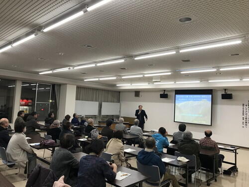
2026.02.23
Signs of Spring in Samani
The daily temperatures are starting to warm up.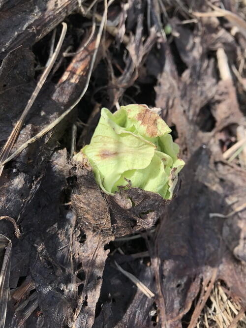
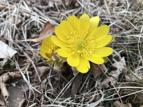
I saw a fukinoto (butterbur) and a fukujuso (pheasant's eye) flower for the first time today!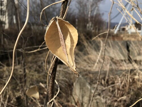
Gagaimo at the Samani Junior High School
I also heard the call of a black kite (hawk) for the first time in a long while.
2026.02.08
February's Warm Wind Cave Event
The "Explore the Warm Wind Cave at Mt. Kannon" was held this February, as part of a series of events to explore the wintery outdoors. 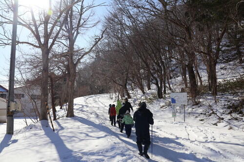
The participants gathered at the lower parking area and walked our way to the top of Mt. Kannon.
We had great weather for the event. I was worried that the path would be slippery after we had a light dusting of snow the previous two nights in a row. Luckily, it wasn't, and we had no issues walking to the top. 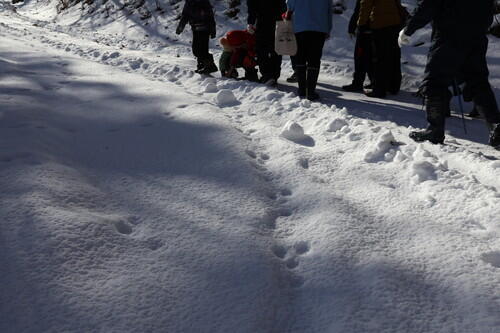
We came across some rabbit prints in the snow!
We also saw azaleas, Japanese honeysuckle, acorns, and seeds from the Ooubayuri.
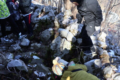
I encouraged the participants to feel the warm air coming from the cave.
My guess is the air was around 7 degrees Celsius. The outside temperature was below freezing, and my glasses fogged up.
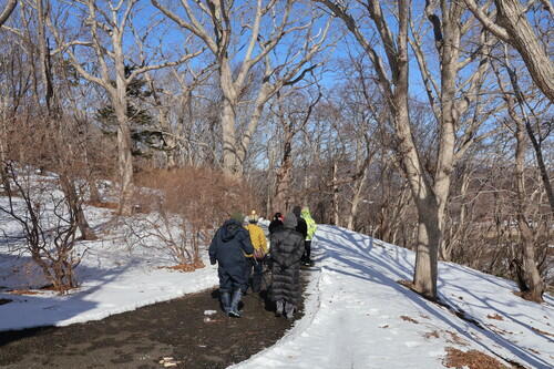
We also walked to the observation deck.
Yesterday, Mt. Apoi was hidden in the clouds, but it was clearly visible today!
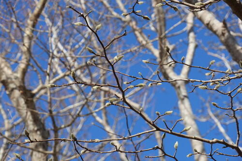
We saw the fluffy winter buds of the Japanese magnolia trees.
All of the photos posted here were taken by the Samani PR Department.
I'm glad everyone seemed to enjoy themselves, and above all, I'm relieved that the event was held safely.
To finish out the event, we warmed up with pound cake from Mokkajyo, a confectionery shop that opened in Samani Town on December 10th, along with warm drinks.
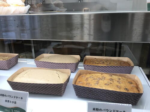
Matcha and red bean, walnut and banana pound cake.
The pound cake is made with rice flour, so it's recommended to warm up the cake in a microwave before eating. 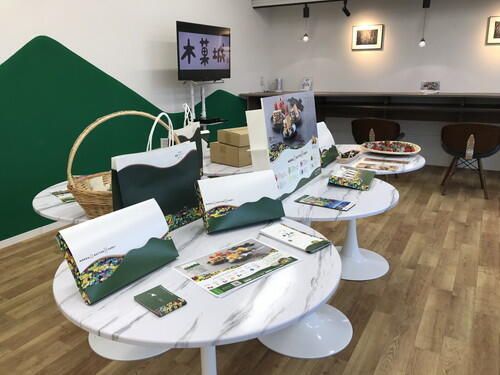
This is what the inside of the Mokkajyo looks like. Pamphlets are also provided.
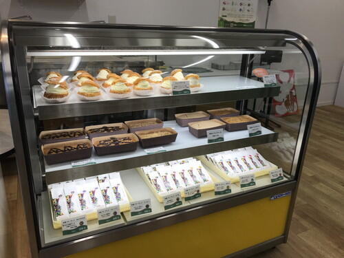
The showcase.
The shop also sells cream puffs, chocolate pound cakes, and butter cream sandwiches.
We might hold the next event in October when the warm air cave is at its warmest (around 17 degrees Celsius), and observe autumn plants, fruits, and seeds.